Showing posts with label Weather Climate and Associated Hazards. Show all posts

Tuesday, 12 June 2012

Monsoons

Hello everyone!!! I suspect the nerves are starting to kick in so good luck to everyone doing the AQA A2 Unit 3 Geography exam! This is a rather late request from quite a few people so I thought I would quickly write it - last minute cramming always helps right.....

MONSOON = a large scale seasonal reversal in wind direction

This wind reversal is experienced in regions across the world but the most significant is the South East Asian Monsoon (this is our example of a climate in a tropical region) and is influenced by three main factors:-
1. Movement of the ITCZ - moves with regards to season as point of maximum insolation changes due to the 23.5 degree tilt of the Earth so ITCZ moves north of equator during northern hemisphere summer
2. Differential heating of land and sea which initiates pressure differences - land masses heat and cool quicker and to more extremes in relation to smaller heat changes over nearby seas; these differences are responsible for strength and direction of winds
3. Himalayas, which are high enough ot influence the general atmospheric circulation in the region

Summer: SW Monsoon = June - September
  • ITCZ dragged north
  • Low pressure over India
  • Land warmer than ocean
  • Coriolis deflects northerly winds to the east
  • Heavy rains move north along west and east coast
  • East rains deflected west due to Himalayas
  • Pattern of rainfall in summer monsoon is altered by topography. Western Ghats create rainshadow in central India, whilst Himalayas have same effect for central India
  • Some areas of SE India and Sri Lanka recieve rainfall in winter as winds pass over Bay of Bengal and gain moisture
Winter: NE Monsoon = October - May
  • ITCZ dragged south
  • High pressure over central Asia
  • Land cools rapidly
  • Coriolis deflects southerly winds to the west
  • Dry air dries further as it moves over Tibetan Plateau
  • Air warms as ut descends to the Indian Plains
- Monsoon in both retreat and arrival is stepped so Sri Lanka gets rainfall in early May whereas Pakistan in July. Retreat begins in September but does not reach Southern India until late November

Couple of facts.....
- 40C in May - average temperature is 30-35C year round
- 13000mm rain per year in Cherrapunji (well its spelt something like that!)
- 80% rain falls between June and September

Positives : )
- Very predictable!
- Relief from hot season as monsoon cools areas that reach 45C so cities have powershortages
- Reservoirs topped up
- Crop growth = stable diet is rice and Indian agriculture built around monsoons
- Monsoon clears out dust and pollution and rejunventates vegetation

Negatives : (
- Temperature restricts tourist season
- Droughts and issues with water supplies
- Flooding increases spread of water bourne diseases
- Restricts agricultural productivity
- 500 died in 1994 flash flood in Bangladesh

Monsoons and Global Climate Change
  • Half of global population rely on annual monsoon to bring water for agriculture
  • Variations of timing and intensity will affect billions of people
  • Frequency has increased 10% since 1950s and severe rains have doubled
  • Impacts of heavy rains i.e flash floods/landslides which then impact agriculture
  • Temperature increase of 3C means some areas get more rain, others droughts
  • Increase in malaria and cholera
Well I think that is about it for monsoons, well atleast I hope so as I don't think I really know anymore and the exam is tomorrow afternoon.

Good luck everyone!

P.S after unit 3 is out the way I will try and write some stuff for 4B at the weekend but remember all the skills stuff is already on here from January!

Thursday, 7 June 2012

Depressions

I have had lots and lots of requests for this one!!! I am going to try and explain it as best as possible but just shout if there is something I havent done so well - some of this climate stuff gets quite tricky so if you are struggling it is probably best to go to a workshop or ask on the FB page rather than just rely on what I am about to write, although I am hoping this is will stilll be useful!
Depressions form when two air masses with differing characteristics meet. Above the UK this is usually polar maritime (PM) air and tropical maritime (TM) air, which is seperated by the polar front.
Warmer, lighter TM air rises, because, being warmer it has a lower atmospheric pressure so is less dense. As it is warmer, it also carries more moisture than the cooler polar air mass and, as it rises, it cools and condenses and produces water droplets and consequently clouds. This is the embryonic stage and the depression moves in a north easterly direction, under the influence of the Polar Jet, whilst Coriolis establishes the anti-clockwise circulation that permits more Tm air to protrude into the depression. As the depression matures, warm air rises over colver air to the east so lower pressure is created, with adiabatic cooling of air. This adiabatic cooling forms high altititude clouds, followed by lower cirrostratus, altostratus and nimbostratus from which heavy precipitation for a long period of time occurs. Where Tm air remains in contact with the ground, indicating no forced ascent, skies remian clear and cloudless but the faster moving cold front, where strongest winds are generated, force cumulonimbus clouds that prodcude heavy precipitation. Once all the Tm air has been 'forced' off the gournd and the two fronts have caught-up with each other, occlusion occurs. This is marked by a decrease in cloud cover and wind speeds, after a period of steady light precipitation, and an increase in pressue which signifies the decay of a depression.

This is quite a good animation if you are a more visual learner. I think explaining depressions is easiest with diagrams like we used in class but I am struggling to find good diagrams
http://www.ngfl-cymru.org.uk/vtc/depression_and_fronts/eng/Introduction/mainsession.htm

Knowing what weather is associated with each point also seems to be important and this is largely due to whether clouds have formed - the animation covers this quite well. When Tm touches the ground you get nice warm(ish!) weather, with clear skies so no rain. In complete contrast at the cold front where winds are strongest you get cumulonimbus clouds forms which bring the heaviest rainfall. During occlusion as high pressure starts to be created and moisture leaves, you get steady light precipiation and winds. The basic idea is that weather changes as a depression travels over an area and matures!
We also have to be able to find the three distinct stages on a synoptic chart - have a go with this one!
The very unscientific way I remember it is that:
                                   Occluded = icicles and suns are fully mixed
                                   Mature = icicles and suns may mix at top but are largely separated
                                   Embryonic = effectively a line of suns and a line of icicles

This is not an easy topic, but hopefully this helps - lets just hope that it does not feature too much in the exam!!!

Wednesday, 23 May 2012

Jet Streams

First up, good luck to all students sitting the Geography exam tomorrow! Now, I have been refraining from writing any climate stuff for a while now but I thought I had better start sometime pretty soon! A while ago Millie covered the basics very well in one post so I will skip that bit (if you want me to go over it again, just let me know!) and so I am going to pick out bits people have said they struggled with the most. So tonight I am going to start with Jet Streams; before going on to the joys of depressions!
Just to ease you all into the subject, here is a little clip produced by the Met Office; on their youtube page they have lots of similar animations/videos for different parts of the climate module that cover the basics.....


Jet Stream = fast flowing, meandering winds found at high altitudes (top of the troposphere), moving west to east (I find it easiest to think of them as 'rivers of air' - my reasoning should become clearer later!). They can travel up to 250km/hr and there are two in each hemisphere:
      - Polar Jet = between polar and ferrel cells, 7 - 12km and fast moving
      - Sub-tropical Jet = between hadley and ferrel cells, 10-16km and weaker due to greater circumference around the Earth

Why do Jet Streams exist?
They are caused by extreme pressure differences in the troposphere generated by the decreasing height towards the poles
           - Hadley Cell = 16km high
           - Ferrel Cell = 12km high
           - Polar Cell = 9km high
This high pressure gradient causes strong winds and as this pressure gradient is greatest at the junctions between the cells it is here that the jet streams are found. As with any moving substance it is deflected by the good old Coriolis Force so they move from west to east.

However, their path is not simple as they meander (just like rivers!). These meanders are known as Rossby Waves - the posh way of describing Rossby Waves is that they are undulations in the path of the Jet Stream that, when become more sinuous (again, just like rivers!) over time, cells of polar air break free.

- The crest of the wave (poleward end) starts to turn back towards the equator so the winds are slowed by Coriolis  and so piles up. This causes convergence, therefore some air must move down towards the surface = anticyclones
- Where a trough (equatorward end) of the wave swings back to the poles, the winds are accelerated by Coriolis, leaving behind less air that the rest of the jet steam, and as such, sucks air up from the surface creating a low pressure system (divergence) = depressions
---> Generally more Rossby Waves occur in winter than in summer (normally 4 in summer, 6 in winter) as north/south pressure gradient is greater over winter when the poles are icy and this increasing strength of the pressure gradient generated more intense and frequent Rossby Waves

That is kind of the sciency bit out of the way but why should we care I hear you all cry! Well, these Jet Streams have great influence over weather.....

- The subtropical jet is found 25 -30 degrees north and south of the equator but does not cover Asia in the summer. This jet is associated with high levels of converging winds which create constant high pressure at the surface (air is sinking) - a crucial characteristic as winds are then forced to diverge, completing the Hadley and Ferrel Cells - this means practically constant anticyclonic conditions at this latitude, leading to formation of deserts

- The polar jet is found 40-60 degrees north and south - yes thats, right, that means it affects UK climate alot! When the polar jet is more southerly, it brings cold air down to the surface (high pressure). The warmed jet then travels northwards (rises, thereby generating low pressure) and brings rain = formation of depressions! Essentially the path of the ket stream steers cyclonic storms in the lower atmosphere and so are useful in relation to weather forecasting i.e 2007 UK floods result of polar jet moving south for the summer where it became stuck under trough of a Rossby Wave. Here is a Met Office blogpost explaining why the jet stream is to (partly) blame for unusual weather these past few months in the UK.....

So thats about it for jet streams I think, I hope it makes sense! Next up is depressions!

Sunday, 29 April 2012

Geography related Books and Films

Teachers may disagree with this but I dont necessarily think that staring at a textbook all night every night is the only way to revise. Of course there is no substitute for hard work but sometimes (especially for development) I think that watching a relevant film can be quite good. Now for those of you who have kept up with your three hours extra reading each week since Septembet (haha!) then you may have watched/readed a few of these but seeing as a few have asked me for suggestions, I thought I would just qucikly write it all up on here! Follow the links for more detailed reviews, explanation of relevance to modules and trailers....
Development and Globalisation:
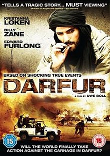
Darfur - a group of international journalists travel to a village in Darfur in search of evidence to persuade the UN that genocide has occured but are forced to live after the Janjaweed turn up and threaten to kill them. I am sure you are all aware of the Darfur Crisis and it is a case study you caould name-drop into an answer, also could be useful AS population module but be warned it is very graphic and definetly not one for the faint-hearted!

Invictus - after 27 years imprisionment, Mandela becomes South Africa's first elected president and this film follows his bid to unite the country via the rugby world cup, seeing unification as a prerequisite to development.

Goodbye Bafana - follows the unlikely friendship that forms between Mandela and his prision officer and illustrates some of the social and political impacts of colonialism in South Africa and how they continued to hinder development.

Blood Diamond - amid the explosive civil war overtaking 1999 Sierra Leone; it explores many issues including those surrounding the diamond trade, supply of arms to rebels and child soldiers. This includes links to globalisation, colonialism, the 'paradox of plenty' and simply how civil unrest prevents development.

Painted Veil -  set in China, in the 1920's, and explores the impact of a cholera outbreak on a village, including references as to how religious beliefs make containing cholera even more challenging and the impacts of an earthquake. Focuses quite a bit on the importance of a water supply to development - the link to the module is slightly more tenuous than with some of the other films and books but it is still worth a watch!
Cry Freedom - in South Africa and tells the true story of Biko and his friendship with a white liberal newspaper editor. Good film to watch for development as explores impact of apartheid on development and the importance of political stability for development to occur.

Gandhi -  a biopic about the life of Gandhi with particular reference to his prominent role in India's struggle for freedom from colonial rule.

Slumdog Millionaire - provides an insight into the life of children living in the Indian slums the problems associated here. Also illustrates how they are trying to improve education to enable development.

Erin Brockovich - a good film that presents the negative impacts of the natural gas industry and the extent to which large companies are prepared to go to, to cover this up. Not only would this be good for the AS Energy module but also globalisation with reference to the negative impact of TNCs.

The Constant Gardener - a rather sad story about how a drug company exploit the Kenyan population to allow them to test a new drug, despite the fact they know it has harmful side effects. Also explores the idea of corrupt governments and issues faced in LDCs.
The Cove - this film is very thought provoking and presented the issues surrounding the dolphin trade - before watching this I didn't know a lot about the issue, especially the scale of it in Japan, and it left me feeling very shocked that something like this still exists today in such a developed country. Issues of groupings, tied aid and trade are briefly explored also.

Blood River by Tim Butcher - tells the story of Tim Butchers quest to retrace the journey taken by H.M Stanley in the 1870s. from this you get an insight into the history of the Congo and the factors have effected its development - great book for the development and globalisation module as it provides an insight into the impact colonialism has had on Africa. Chasing the Devil: On Foot Through The Killing Fields of Africa is another Tim Butcher book, although this time based in Sierra Leona, that covers many issues intrinsic to low levels of development in Africa and the problems associated with this.

The Boy Who Harnessed The Power Of The Wind by William Kamkwamba and Bryan Mealer - tells the extraordinary true story of a Malawian teenager who overcame many obstacles to provide electricity and clean water for his village by capturing the energy in both the wind and the sun. Good for AS Energy as well as A2 development and illustrates the importance of energy supplies and appropraite technology to development. It also touches on the issues of living in areas of climatic extremes, the role of education and how corrupt governments influence aid distribution.
PeopleQuake: Mass migration, ageing nations and the coming population crash by Fred Pearce - a book about the population bomb and how demographics is driving politics. Explore how we got to this point and where we are currently heading and how it can be solved. Therefore it is a great book for AS Population (covers practically the entire module with some useful case studies and statistics!) and for A2 development and Globalisation. Human geographers will not doubt love this book but any geographer out there, like myself, who get carried away with the science and forget to mention people, this book is worth a read!
Globalization and Its Discontents by Joseph Stiglitz - as chief economist at the World Bank that author has a unique insider's view into the management of globalisation. In this book he speaks out against the IMF and WTO and the role of the West in driving global politics. This makes it a very good book for globalisation!

Plate Tectonics and Associated Hazards:
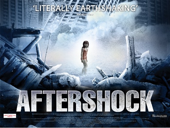
Aftershock - based around the Tangshan 1976 earthquake, which killed 242,000 people and coincided with huge political changes in China. This film cover issues including aid, politics and follows China as it changes over the time period covered. However, it is centred on one question; which 7 year twin will the mother chose to save? Bewarned it is a very said film, Millie was not overexaggerating when she said it was!

Dantes Peak - we watched this one in class, the worksheet we used in lessons is on Millie's blog so this could be a useful thing to watch and complete again as part of your revision. Covers preparation, evacuation and monitoring techniques as well as a few inaccuracies that you should be able to point out!

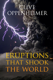
Eruptions That Shook The World by Clive Oppenheimer - I havent quite finished this book yet but I thought I should mention it as I am finding it quite useful for finding the odd statistic or two! Bascially this book covers everything we need to know about volcanoes and a bit more! Geologists, this is probably a really good book for you to read, but for Geographers it does link all the volcano stuff back to its impacts on people.

Weather, Climate and Associated Hazards:

The Day After Tomorrow - the Larsen B ice shelf collapses, the thermohaline circulation shutdowns, provoking glacial inception in the northern hemisphere, with other appending impacts - a good film to watch and then point out the geographical/scientific mistakes to test how much you have understood about the influence of ocean circulation on global climate and how a freshwater input could affect it!
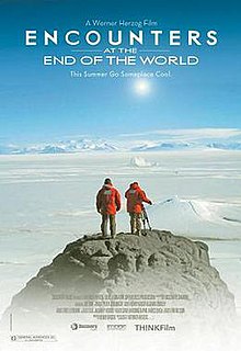
Encounters at the End of the World - a great documentary with some simply stunning footage and interesting interviews that collectively provide an insight into life in Antarctica and the important research that is taking place
The Age of Stupid - great film to watch for the energy module as it talks about climate change, energy consumption and production via some interesting case studies so also good for the A2 climate module
Gaia by James Lovelock - presents the Gaia hypothesis which is the idea that the Earth functions as a living organism and so self-regulates to adapt to changing conditions. This book puts forward some very interesting ideas, linked very closely to climate change both naturally and anthropogenically forced, making for an interesting read!

 The Revenge of Gaia by James Lovelock - applies the Gaia hypothesis to global climate change - again an intriguing read which presents some interesting ideas and solutions to problems we are likely to face with population expansion and coming global climate change
An Inconvenient Truth by Al Gore - I am guessing most will have heard of this one! It presents the issue of climate change and discusses how it has been caused and the impacts it is likely to have - well worth a read but if you prefer there is also a film version.

Our Choice by Al Gore - this book follows on from An Inconvenient Truth by offering the solutions Al Gore thinks are required to solve the issue of global climate change
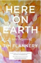
Here on Earth by Tim Flannery - This is essentially a "revolutionary dual biography of the planet and our species." It covers the history of the earth from its earliest origins to the world we currently live in. it offers answers to a long list of questions - How did life first emerge? What forces have shaped it? Why did humans come to dominate? And when didiwe start to have an impact? How has this changed use as a species? It is probably wise to have a bit of knowledge of the Gaia hypothesis before reading this as it does mention this a bit. It is a very interesting book and one that leaves you questioning why on earth we did some of the things we have and continue to do - essentially a great book for all Earth Scientists!

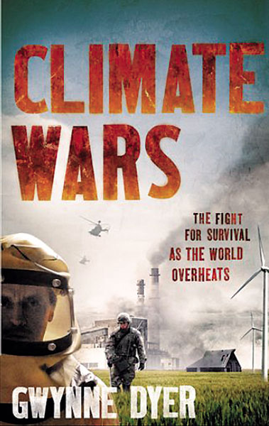
Climate Wars: The Fight For Survival As The World Overheats by Gwynne Dyer - "An increase of 2C in average lobal temperature - which is almost inevitable - will hear global politics to boiling point." Bringing together extensive interviews and latest research this book revela the realities of a planet facing scarce food, water and land. Can out technology save us, or is it too late? It is written in an interesting way as takes the science, makes it understandable before focusing on what excatly this means for society now and in the future. Any geographers out there, like myself, who get too carried away with the science of climate change, without consideration of what that means for people, this book is definently worth a read!!!
Storms of My Grandchildren: The truth about the coming climate change and our last chance to save humanity by James Hansen - covers global climate change, with both causes and consequences and the more contemporary role of politics, especially in the USA, in climate research - an interesting read but in places the level of science goes beyond the A-level syllabus.

Well, there are plenty more but this is probably enough to keep you busy for a while! There are also all the relevant documentaries, parts of which we have watched in lessons, like How Earth Made Us, for example, and I think quite a few of them are in the LRC. Unfortunately not many Geography related things are that happy so perhaps don't watch/read them all at the same time! I am still on the hunt for a 'happy' geography film or book! If you have any suggestions for others, or any comments on the above, let me know!


Wednesday, 25 April 2012

Climate Modelling - [based on video notes from Earth: The Climate Wars]

Hello everyone! I hope the revision is going well; only like 8 more weeks of hard work and then it will all be over!!!

Climate modelling is a really, really complicated mathematical area and I got the pleasure of spending some time with many of the worlds best climate modellers whilst at the Met Office. During my time there, understanding modelling was an area that I really struggled to understand and my inquistive nature lead to much confusion on my part (sometimes I really need to just accept things!). Fortunately it seems that we dont really need much knowledge on the modelling but I thought I would summarise what we should have learnt from the documentary we watch - if anyone fanices learning more, this could be a good topic to look into over your long summer holidays (it is on my list for looking at!) and there is some stuff on the blog about it; word of warning though, the maths get very confusing very fast!!!

Here is the links to the three episodes, in order - we only watched the third one in class....
- The worlds first climate models were far from computer based! Instead small scale models were used and these helped to formulate the basics of atmospheric circulation, allowing scientists to generate the basic laws that the atmosphere abides by. However they failed to represent the complex oceanic/atmospheric intergration or predict weather patterns
- Computer modelling was first used to predict the weather on a 24 hour timescale. However, at first it was taking 24 hours to produce a forecast and was not until the 1970s that this became efficient enough and worked reasonably well
- Early on, the models were not deemed that reliable and consequently many climate skeptics used this as a point of attack, saying that as results were not reliable, it could not be said that climate change was happening in reality
- It was not until the 1991 Pinatubo eruption that the models could be tested to see if predictions were accurate. Hansen, a world leader in climate modelling used the eruption to see if the models predictions of the extent of cooling caused was accurate. This event was ideal due to timing of eruption and duration of impacts. The 1980 eruption of Mount St Helens unfortunately came to early to be used to test modelling accurracy due to level of computer technology at that time
- Subsequently, by the late 1990s climate models were deemed, worldwide, as reliable and so their projections viewed with confidence. At this time the models were suggesting that a doubling of CO2 would increase global temperatures by 3C. However, this will never be 100% accurate as resolution of the models still needs improving and modellers still struggle to ensure computers consider influential factors in affecting climate on a smaller, more local scale - this is quite a good explanation of why climate modelling has improved over the years, produced by the Met Office -  Climate Modelling


- There is also the complication of field observations, which are crucial in producing the models, and the increasing level of understanding we are gaining over time. This is an inherent problem with climate modelling and will continue to be as we discover new feedbacks operating in the climate system. The example in the video was based around glacial movements as a once believed 'dead' glacier became 'alive' again and started moving at a faster rate, as the planet has warmed, this has then increased the rate of sea level rise etc. Feedbacks control the extent of change with negative considered stable and positive feedbacks often detrimental due to their amplyfing effect. These feedbacks are very hard to model  so uncertainities will always exisr with modelling; meaning tht changes in sea level, for example, could happen a lot quicker than models predict
- 1961: Lorentz's discovered 'chaos' in the climate sytem by changing degree of rounding used in models and this went on to explain variations in modelling projections. Thousand of runs and run and the general trend is then taken and countries all use different models. The UK uses the Met Offices HadCM3 which was influential in both IPCC AR3 and AR4. Ensemble forecasting is being used to an increasing degree. Ensemble forecasting basically means that all the different runs are started at slightly differing conditions and then by comparing the results it produces a much better idea of what weather events will occur at a given time.
- The discovery of the 'Chaos Theory' made climate scientists realise that there were factors with an influence on climate that they had yet to discover and incorporate in models or to quantify their signigicance
- Proxy data such as Greenland ice cores and pollen and beetles help us formulate the temperature record going back to the Younger Dryas. Understanding how past climates have changed and incorporating this knowledge into modelling helps to make long term prediction more accurate than say the 5 day forecast. The proxy record also indicates that abrupt climate change is possible
- So, far Antartica seems to have experienced the most rapid climate change, especially in terms of sea ice coverage. In 2007 sea ice shrunk by an area 10 times the size of the UK, leading to some scientists predicting that in a decade no sea ice will remain during summertime in this area
- Models say that warming may be slow and steady but history indicates it can be rapid and so we are now experiencing changes happening at a faster rate than model predictions and faster than we originally thought
- Technology has allowed us to deal with some climate condition e.g Las Vegas is built in a desert yet is full of water, thanks to the Hoover Dam which created the 100 mile long Lake Mead. An 8 year drought has been experienced in this region though and models suggest that the drought will continue and, as population expands, water will become scarce and Lake Mead will become ineffective by the late 2020s

So, these are all the notes I managed to take! The basic knowledge we need to have for climate modelling I think is a bit about when they were developed, how they started off etc and then why there are uncertainities and why they are still considered unreliable. Within in this, you need to be able to link in the use of Mount Pinatubo and proxy data to reduce modelling unceratinity but meanwhile realise that they will arguably never be 100% certain. Hopefully I have covered all of this!

Sunday, 18 March 2012

Why are us British so interested in the weather???

Just a quick post before I am off to Iceland for a week!!!

Last week we learnt all about what produces the British weather and arguably one of the reasons we seem to take such an interest in it is that it is best described as changeable, as dictated by 5 different air masses influential to UK weather. Despite the variability, we rarely witness extremes, which is perhaps a fortunate thing considering how badly we seem to deal with them!

Cool Temperate Western Maritime is how we describe the climate of the UK and other countries that have an ocean to the west and are 40-60 degrees north and south of the Equator, and so really the name is quite self-explanatory! Western Canada, parts of Chile and New Zealand also experience this climate but the spatial extent is restricted by relief as mountain ranges (i.e Andes in Chile and Rockies in Canada) force the moist air to rise, clouds and precipitation form but this generates a rainshadow on the eastern side, hence the further influence of this climate inland in Europe (possible link to tectonics!).

Maritime climates are important a places with such climate have warmer conditions in winter than you would expect from their latitude. This is because water has a greater specific heat capacity than land and takes longer to warm ip and cool down, so in winter water keeps the area warmer. However, summers are often a little cooler than expected because the cloud cover reduces the amount of sunlight that reaches the ground. Therefore, it can be argued that maritimes climate was crucial to British development considering we followed the path outlined by the Rostow Model of Development....

This Met Office page is quite good, although designed for teachers, for explaining some of the basics (with even a quick mention of one of my favourites, El Nino!) http://www.metoffice.gov.uk/education/teachers/in-depth/understanding

Air masses are named according to their source, either Tropical, Arctic or Polar, and whether they came from land (continental) or sea (maritime). The UK is affected by Tm, Tc, Pm, Pc and A. When Pm and Tm meet along the polar front, depressions form qith warm and cold fronts that produce heavy frontal and orographic rain.

When I get back from Iceland I will write a post specifically on depressions as their is quite a lot to cover, as well as Monsoons and perhaps a bit of information to help with that lovely assignment Millie has set us (if I have the energy and am feeling nice!). But for now, I am sorry but this is going to as I should probably hunt around for my passport before sitting down to watch Orbit (catch it on iplayer if you have missed any http://www.bbc.co.uk/iplayer/episode/b01d7kd5/Orbit_Earths_Extraordinary_Journey_Episode_1/ ).
If I get the chance, I will blog from Iceland but, if not, I am sure you will hear about it when I return.

Fellow Icelandic Adventurers, see you bright and early tomorrow morning and I promise, I will try and refrain from asking too many questions throughout the week!!!


Wednesday, 7 March 2012

Where would the British be without the Gulf Stream!?

Hello everyone! Hopefully everyone is enjoying the new climate module! Millie has written a very useful and succinct summary (something I never manage to achieve!) post on all the basics we have covered so far so there is no point me doing it to......instead I am going to write a little about the ocean circulation. After a polite reminder that Geography is the study of peoples interaction with the environment I am going to focus on the impact that the Gulf Stream has had on our development and the way society functions; projecting this into the future to examine how we would cope without it; rather than focusing on the science (although this is incredibly interesting, for the exam, unfortunaltely we do not seem to need to know that much - however feel free to ask lots of questions as this links with my EPQ topic).
I will get the sciency bit out of the way first....
This is a graphic I produced as part of my EPQ and so perhaps goes into a little two
 much detail but the image in the top left hand corner illustrates really well the role of the
Gulf Stream in heat transfer
- Continents divide the oceans up into basins and so this complicates the direction of currents which are already inlfluenced by Coriolis in the same way as winds
- Gyres (large circular) form and move clockwise in the Northern Hemisphere
- Currents are driven by winds, Coriolis and the sinking of cool water near the Poles
- Antarctic Cirumpolar Current is the only current that goes right the way around Earth, preventing icebergs from entering the oceans - this is important when analysising possible threats capable of perturbing the ocean circulation
- Gulf Stream is initiated as water moves across the Atlantic from Africa to the Carribean. As it travels close to the Equator is gets heated. It then gets deflected by landmasses, Coriolis and other factors and so flows along the Florida coast. As it reaches higher latitudes it gets colder and saltier (we say salinity increases) as when ice forms, salt is removed from the fresh water and left behind in the ocean (brine rejection). This makes it more dense so it sinks.
- The Gulf Stream is a surface current but there are also other currents than flow deeper in the oceans. Together they connect all of the world's oceans, transporting heat, and forming the Global Conveyor Belt

I will get into trouble if I talk anymore about the theory but just a quick mention for the deep water circulation (just ignore the next paragraph if you don't want to know anything more than we strictly need to - the bit after is very relevant though)......
Another graphic I made for my EPQ - atleast they are coming
 in handy!
All the currents are linked in a complicated way and are dependent on each other. The sinking of Gulf Stream waters at high latitudes, feeds the crucial Thermohaline Cirulation (THC). Due to the combination of high evaporative salt enrichment and Gulf Stream presence, THC is best developed in the Atlantic. The Gulf Stream transports warm, salty water to the north-east of the Atlantic where it cools, mixing with the cold Arctic Ocean waters. This causes it to become dense enough to sink, both to the south and east of Greenland. The resulting current is part of a larger system that connects the North Atlantic to the rest of the Atlantic, Indian, Pacific and Southern Ocean, where the two main sinking regions spread out in the subsurface ocean, thereby able to influence the world’s oceans from depths of 1000m and below, before the cold, dense water gradually warms and returns to the surface. Basically, the Global Conveyor Belt consists of surface and subsurface currents, sinking regions and return waters which interlink to form a closed loop. The conveyor starts in the Atlantic where salty water proceeds northwards to Iceland, is thermally densified, and thus sinks through the interior to form the conveyor’s lower limb. There are also deep-water flows such as the North Atlantic Deep Water (NADW), which have great influence on our lives. THC is very important. THC engages the entire ocean into the climate system by permitting ocean water to directly interact with the atmosphere (over a timescale of 100-1000 years), ergo, via the Gulf Stream and NADW, moderates the UK’s climate – one that is, consequently, on average, 5°C warmer than countries of similar latitude. On a more global scale, THC influences biome distribution, NPP, sea level, ITCZ movement and productivity of oceans whilst individual currents themselves allowed for the early navigation of the oceans, thus aided development. However, the present pattern has not always existed and is vulnerable to many external factors and cyclic atmospheric changes. Even a significant weakening would have multiple detrimental impacts, with the effects being globally experienced and, as the oceans control the Earth’s climate over decades to centuries, understanding how they are likely to change is crucial in selecting how to appropriately mitigate and adapt to future climate change.

Why is the Gulf Stream important for the UK?
Raises air temperatures, thereby helping to deliver mild winters and cool summers to the British Isles. The warmer waters have a significant impact on North Atlantic temperatures as they give up about one-third of the energy they had previously stored from the sun. The extent of the warmth provided by the Gulf Stream can be seen by comparing the climate of countries at a similar latitude to Britain's - i.e Canada which is a bit colder! It is believed that the UK climate is 5°C warmer than it would be without the Gulf Stream. Warming effect of Gulf Stream prescence enabled agricultral productivity to increase, permitting an acclerated transition through the early stages of the Rostow Model of Development. 
Perhaps the easiest way to understand the benefits of having the Gulf Stream nearby is to summarise the impacts on society if it was absent. Whilst there are many extrinsic forcing factors capable of shutdowning THC, thereby causing a southward shift or even complete shutdown of the Gulf Stream, the most likely is a large freshwater input at high latitudes due to melting ice, consequential to global climate change.........

How would the UK cope without the Gulf Stream?

This area is currently recieving a lot of attention (this is what I focused on when at the Met Office) and model simulations suggest that freshwater forcing of a shutdown, as a result of global climate change, could cause:
- 8C cooling
- Increase in wind speed
- Precipitation reduction
- Storms tending further north so hitting UK with increasing frequency
- 1-2 months additional snow cover
- 80cm sea level rise
- 2% reduction in the UK's GDP
Sea level rise is potentially worrying for the UK as factoring in isostatic readjustment, population growth forcing more onto marginal lands and £130 billion worth of assets currently at risk of coastal flodding, greater than 10% as present, of our coastline would need to be protected. Even factoring in global climate change, the UK would still see reduced precipitation and 3C reduction in temperature. Increased snow cover would drastically decrease mobility, isolate people from an alrady straioned health care amongst other amenities, instigate higher living costs due to restrictions on agriculutre and issues with transporting food (in 2010 one milk company had to throw away 100,000 litres of milk) and cause huge disruption to education (altough, I don't think us students would mind a few more snow days!!!). Lower temperature and prolonged snow cover could cause issues for the UK's ageing population, with 1/4 in the southwest unable to heat their homes, possibly initiating greater urbanisation with cities able to offer facilities in close proximity, more likely to recieve greater funding for protection and the urban heat island effect warming, on average, summar and winter by 5C and 2C respectively. Consequently, a shift in employment could be experienced, with construction work becoming more seasonal and people looking for office-based work that can be completed from home during winter moths. Restricted agricultural and inducstrial productivity, fewer TNC's attracted whose presence stimulats cumulative causation and reduced touristic value, amongst other factors, is projected to generate a 2% reduction in the UK's GDP (-0.1% of global economy) with politicians put under increasing pressure to develop effective contingency plans to prevent societal collapse during protracted snow cover, minimise economci impacts and provide sufficient protection in coastal areas.

Global Impacts???
The two hemispheres and the atmosphere and oceans are coupled in a way we don't need to understand but this means that, despite centralisation of impacts in the North Atlantic, impacts would be globally experienced. A 1C temperature increase in projected in the Southern Hemisphere, which would only be accentuated by global warming. A southward shift in the ITCZ would occur, reducing monsoon intensity/duration over India - worrying as India's water security is already poor, their rivers are reliant on glaciers, sea-level is threatening to displace millions thus increasing population density and India's population is expected to exceed China's by 2030. A 5% reduction in global NPP would be accompanied by alterations in temperate biome distribution and ecosystem disruption whilst with 20% of the world's fisheries dependent on upwelling systems and risng SST's futher reducing ocea oxygen content, food scarity would become prevalent especially with the global population soaring to 9 billion by 2045.

As you might have guessed, I find all of this stuff really interesting but I get the impression all you really need to know is the basic's of the Gulf Stream formation, a bit about how it has helped the UK and, just that society would struggle to sustain current livestyles without it -  so hopefully this all made sense!


Sunday, 4 March 2012

Atmospheric Circulation

Global Heat Budget - Key Points:
- Excess at Equator
- Deficit at Poles
---> Therefore, as basic rules of thermodynamics dictates, all air and ocean currents transport heat polewards

Convection Cells (= essentially the same as that in the mantle)
- Incoming UV radiation heats the ground and is absorbed before being re-emitted as longwave terrestrial radiation.
- Hot air rises, generating low pressure (cloud formation and precipitation results), until it reaches the tropopause where it is forced to diverge.
- As it cools, it starts to sink, generating high pressure (dry conditions)
- Air will then move back to the source region along the surface, from the area of high pressure to an area of low pressure along the Equator

--> If the Earth did not rotate and there was no landmasses on Earth, then two convection cells (one in each hemisphere) would exist, moving heat from the Equator to the Poles. However the Earth does rotate in a anit-clockwise direction, influencing the atmospheric and oceanic circulation pattern......

Coriolis Force
If the Earth didn’t rotate then both the atmospheric and oceanic circulation would circulate to and from the polar regions (high pressure) to the Equator (low pressure) in a continual motion. However, the incessant eastward rotation of the Earth causes a more complex pattern of movement. The circumference of the Earth is greatest along the Equator and so the eastward motion of the Earth’s surface is greatest here; whereas at the poles, where circumference is at is minimum, the velocity is zero. Therefore, if a volume of fluid (or any moving particle) flows north from the Equator; it will sustain its constant eastward momentum but, as it gets within a forever closer proximity to the Poles, the Earth beneath it will gradually slow, thereby provoking air/water to move to the right, in relation to the Earth. Its general effect on flows is to cause them to turn to the right (east) as they progress north from the Equator and to the left (west) as they migrate south from the Equator. This is the Coriolis Effect and its strength increases as the water (or wind) moves further away from the Equator and thus, the distance that the currents flow away from the Equator governs how far, to the left or the right, they ‘bend’. 

- Surface winds/currents moving towards the Equator are deflected to the west
- Surface winds/currents blowing towards the Poles are deflected to the east
- Along the Equator majpr currents flow from east to west
Therefore, in reality there are six convection cells in operation on Earth.....
Tri-Cellullar Model of Atmospheric Circulation
- Intense insolation on the Equator starts the process of convection, leading to the formation of Hadley, Ferrel and Polar Cells
- The same pattern is seen in the southern hemisphere
- Wind pattern can be explained by the rule that air moves from excess to deficit as with each example the wind is blowing from areas of high pressure to low pressure, and then deflected by Coriolis
- Winds are named from the direction they are blowing from
- Trade Winds are so named due to their use in early trade, most infamously the Slave Trade - this provides a great synopitic link to development, colonialism and globalisation   

Air Pressure Systems
- Rising air moves in an anti-clockwise direction and spirals upwards = depression = low pressure
- Falling air moves in a clockwise direction and spirals downwards = anticyclonic = high pressure = stronger of the two movements
ITCZ = Inter-Tropical Convergence Zone

--> The junction near the Equator where the two Hadley cells land based currents meet
- Its position changes with regards to seasons.....
---> British Summer Time = ITCZ north of the Equator so low pressure over India (=rain!)
---> British Winter Time = ITCZ south of the Equator and higher pressure over India
- Over land the ITCZ shifts furhter north or south of the Equator die to differences in the albedo between land and the oceans

I hope this is helpful - let me know if there is something I did not explain very well. On to Jet Streams and Rossby Waves next!!!

Friday, 2 March 2012

Start of the Climate module!!!

This week we started the much anticipated climate module (at last!). Anyone who knows me will know that this is probably my favourite area we study so apologises to my class if my enthusiasm turns into annoyance! This means that I will definetly be providing you with plenty to read!!! So, lets get started...

WEATHER = the state of the atmosphere at a given time and place
CLIMATE = the average weather in a particular place over at least a 30 year period

The atmosphere is a mixture of gases, solids and liquids held in place by gravity, and it can be split into 4 layers differentiated by temperature changes:

TROPOSPHERE:- this zone lies closest to the Earth and is weather processes take place. It displays the highest temperatures as solar radiation warms the Earth's surface which, in turn, warms the air directly above it (via convection, conduction and radiation). However, this effect decreases rapdily with distance away from the surface and air temperature drops by 6.4 degrees Celcius with every 1000m gained in height (= Environmental Lapse Rate or ELR). Wind speeds also increase with increasing altitude as friction with the surface decreases. This is the most unstable layer and contains most water vapour and particulate matter. The end of the troposphere is marked by the TROPOPAUSE which is an isothermal layer where the temperature remains constant, despite the increase in altitude. The tropopause marks the upper limit of the zone of weather and climate and jet streams are found here.

STRATOSPHERE:- this zone is characterised by a steady increase in temperature (known as a temperature inversion) as a result of solar radiation by the ozone layer. The ozone layer absorbs much of the incoming UV radiation that would be harmful to humans otherwise. Wind speeds increase with height towards the STRATOPAUSE.

MESOSPHERE:- temperature declines rapidly to c.-90 degrees Celcius in this zone as there is not water vapour or particulate matter to absorb radiation. It is characterised by very strong winds (often approaching 3000km/hr) and its end is marked by the MESOPAUSE.

THERMOSPHERE:- this is so named because of the increase in temperature resulting from the absorption of UV radiation by the atomic oxygen found at this altitude.

Latitude:
- Latitude greatly affects climate i.e rainforest on the Equator and deserts on the tropics, and its influence on climate affects other things too, arguably like development (think about latitudes at which most developed countries are situated.....)
- Latitude should have the same influence on climate in both hemispheres but it doesn't. Why? Well this is where you can link in tectonics - landmass is not equally distributed between the two hemispheres, with most continents in the Northern Hemisphere. Oceans take longer to heat up than land but are better at retaining heat and so different climates are experienced.

Global Heat Budget
- More solar radiation is always absorbed at low latitudes compared to high latitudes. The Equator recieves more energy as solar radiation strikes the Earth head on.
- At high latitudes more radiation is lost as higher latitudes have a higher albedo so reflect the incoming UV radiation back as longwave terrestrial radiation. The 23.5 degree tilt means that at certain times of the year the poles recieve no insolation, whereas the Equator is always subject to intense insolation. Also, due to the Earth's angle of inclination, at the poels twice the area has to be heated and more atmosphere has to be passed through.
= The net result os a surplus of heat at the Equator

BASIC PRINCIPLE OF THERMODYNAMICS:- Heated substances always move away from their source towards cooler areas, hence the Earths circulatory system. This is the basis of both the atmospheric and oceanic circulation. Remember....
   ---> Substances ALWAYS move from areas of EXCESS to areas of DEFICIT
Factors affecting the heat budget:
  • The Solar Constant ---> varies slightly and affects longer-term climatic changes rather than shorter-term weather variations
  • Eccentricity of Earth's Orbit ---> the eccentric orbit of the Earth around the sun can cause up to a 6% variation in the solar constant (this is linked to Milankovitch cycles which we get to learn about towards the end of the module!).
  • Altitude of the sun in the sky ---> Equator receives intense insolation as UV radiation strikes Earth head on. At higher latitudes is approaches at a more oblique angle meaning there is twice the area to heat up and more atmosphere to pass through.
  • Length of night and day ---> 23.5 degree tilt of Earth means that regions near the poles will not receive any insolation at certain times of the year.
  • Sphericity and the Sun ---> higher latitudes make a lower anlge to the sun and the atmosphere is thicker whilst the poles are further away from the sun than the Equator
The beginning of the climate module covers quite a lot of new concepts so I think I will leave it at this for a while - I think the most important thing to remember is that flows move from excess to deficit as, especially for the understanding winds and the Tri-Cellular Model of Atmospheric Circulation, this rule is crucial....