Showing posts with label Rivers. Show all posts

Friday, 13 May 2011

Rejuvenation

After much request, I am going to write a short post purely on the idea of rejuvenation in rivers (to those of you who I said that I would do it on Wednesday/Thursday, I apologise but blogger hasn't been working properly over the last few days).  So, better late than never, here goes........

What is rejuvenation?
Rejuvenation is the renewal of a rivers energy in response to a relative fall in base level. Base level is the same as current sea level and so a drop in base level can be caused by either eustatic sea level fall, isostatic rebound or tectonic activity. Due to the fact that all rivers try to reach the graded profile (a theorectical concept where all three river processes are in equilibrium and calibrated to current base level), a drop in base level usually provokes a restart of erosion, predominantly in the form of vertical erosion. Rejuvenation always starts at the mouth of a river and works its way towards the soure, therefore headward erosion is also active.

How does rejuvenation affect rivers?
The restart of erosion and reduction in deposition, provoked by a fall in base level, leads to the formation of landforms that would not normally be found in rivers.

INCISED MEANDERS:
There are two types of incised meanders, ingrown and entrenched and they can be found in areas like the Grand Canyon.

Ingrown meanders:
:- form when lateral erosion operates too (therefore indicates a more gradual drop in base level) and so the valley floor is deepened which means that the channel only occupies part of it.
:- they have an asymmetrical cross section

Entrenched meanders:
:- created, purely, by vertical erosion (their presense indicates a rapid fall in base level) and often form in hard rock areas.
:- they are deep cut and gorge like
they have a symmetrical cross section

KNICK POINTS:
Knick points appear on a rivers long profile and are, almost, like the steps down a river takes to reach the new base level.  They relate to the extent to which a river has created a new profile in response to the new base level.

:- they can be identified by a break in slope and so are often marked by a waterfall
:- they reflect the process of headward erosion aswell as vertical erosion as the river has a renewed ability to erode vertically
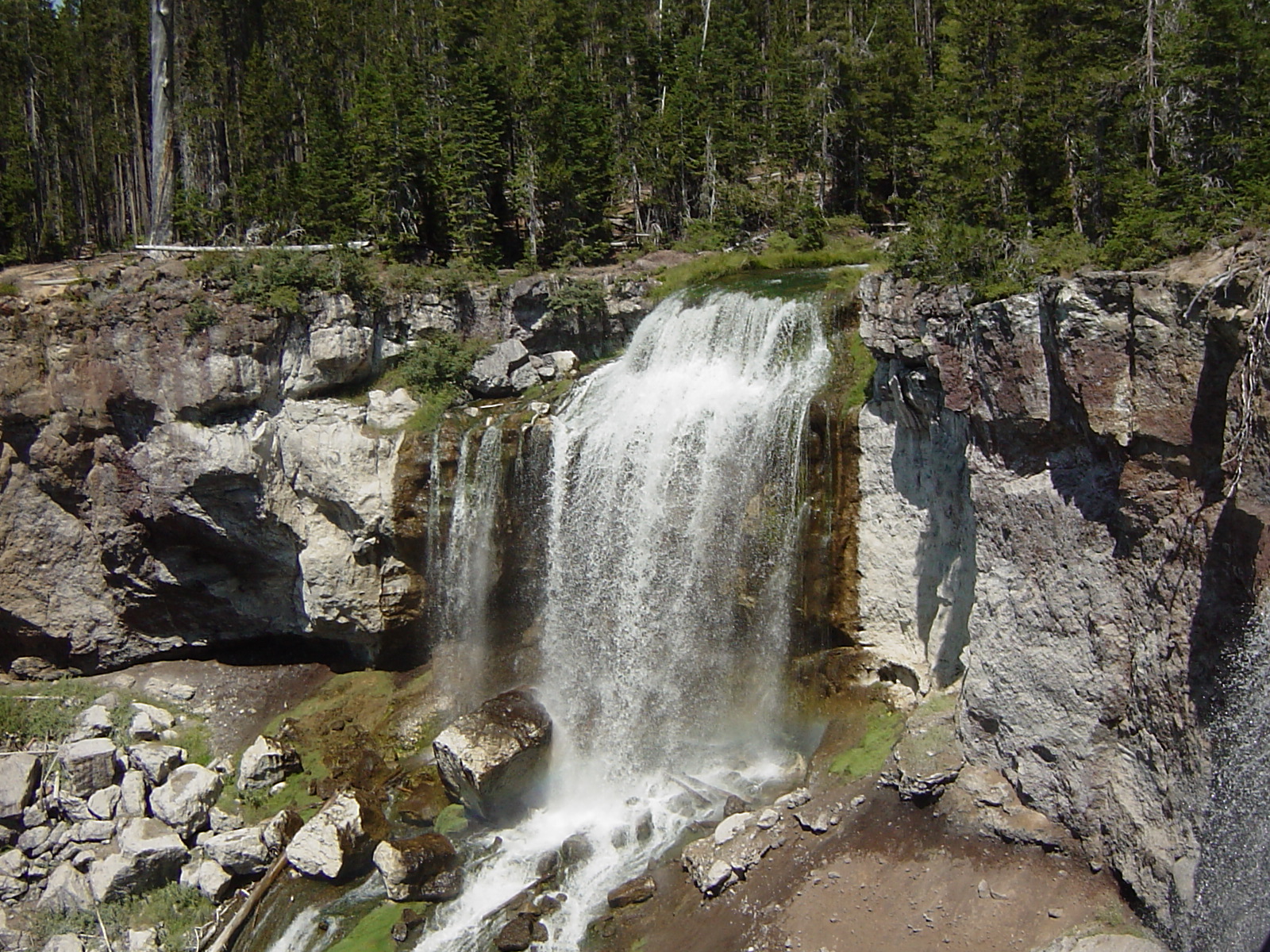
:- Knick points often form waterfalls and, in areas where they form but there is no alteration in rock type, they clearly show rejuvenation has occured as waterfalls normally form due to differential erosion resulting in undercutting

RIVER TERRACES:
There are two types of river terraces, paired and unpaired, and they are the remains of the former floodplain which has been abandoned because the river has eroded too deeply for the floodplain to be accessed. London sits on river terraces and by looking at terraces it is possible to work out how many relative falls in base level have occured.

Paired:
:- they are on the same level on each side of the channel and so indicate rapid down cutting

Unpaired:
:- occur when the fall in base level is slower
:- the terraces will be present on different sides of the channel at different levels. This is because lateral erosion, through meander migration (so mainly hydraulic action and abrasion), has had time to occur


I hope this is helpful and in enough detail. It is quite a tricky area of the rivers model, especially if you are faced with a 15 mark question like 'Describe and explain the formation of landforms resulting from rejuvenation' as it is hard to think of enough to write about but hopefully this will give you an idea on where to start.

Good Luck with the revision over the weekend!

UWE lectures

I realise that many of you were not as fornuate as me and able to attend the two sessions yesterday afternoon run by two lecturers from UWE and, because they were so good, I thought I would share with you some of the things that were discussed.......

Climate Change and River Management:

What is climate change?
Before you can understand the impacts climate change is expected to have on rivers, a basic understanding of what climate change is, is required. Climate change refers to any long-term change in the statistical distribution of weather patterns over periods of time that can range from decades to millions of years; although it is most commonly used in reference to the increase in the average surface temperature of the earth over the recent decades and that which is predicted in the foreseeable future. Much of the work on climate change and its impacts on rivers is based on estimates as it is very hard to predict the future climate as it is dependent on a wide variety of things - although most importantly carbon dioxide emissions. Despite this uncertainity, central estimates have been produced for  changes that are expected to occur within the UK, within the next 30 years.....
  • Increase in  the average summer temperatures of 3-5 degrees Celcius
  • 10-30% increase in the average levels of precipitation experienced during the winter
There will be spatial variations though, from these intermediate values. For example, some areas of the UK are likely to experience a decrease in the mean winter precipitation level whilst others are expected to experience a 50% increase.

What is River Management?
River management is any action that includes intentional intervention by humans into the way that river systems funtion. This includes:
- Managing the quantity of water flowing through the channel ---> flooding, droughts, freshwater supply, reservoirs and flow regime modification
- Managing the stability of river channels ---> rivers are unstable and constantly change due to the processes of erosion and deposition and this threatens to cause major, and very costly damage, to infrastructure
- Managing water quality ---> pollution from littering, industry, sewage, sediment and agriculture (eutrophication)
- Managing the physical quality of the river ---> management of ecosystems to maintain and maximise biodiversity

Although managing water quality and biodiversity etc are considered when it comes to river management, its primary aim is to reduce the flood risk. Reducing the flood risk is a big problem for England and Wales as around 4 million people and £200 billion worth of infrastructure are a risk of flooding. At present, even though we spend roughly £800 milliom per year on flood and coastal defences, we experience £1,400 million of damage. Worryingly, this is the damage caused and the costs associated with current sea levels, temperatures and precipitation levels and so the impacts of climate change are likely to provoke a sharp increase in those at risk and the costs involved with reacting to the risks. It has been estimated that, due to the expected increase in the recurrence and magnitude of floods, that the costs of damage done by them could rise from £1,400 million a year to anything up to £20,500 million over the next 70 years if no further action is taken.

So, how is climate change likely to affect the flood risk........
Flood risk is the balance between the conveyance capacity and the amount of water that is actually trying to move through the channel and it is this balance that climate change threatens to disrupt, thereby increasing the flood risk.

Conveyance capacity is, in very simple terms, the amount of water that can fit in the channel and so when this level is exceeded by the actual amount of water trying to fit in the channel, flooding occurs. Due to increased precipitation levels, climate change is predicted to increase the flow. This means that there is more water trying to pass through the river and so a higher probability that this volume will exceed conveyance capacity and therefore result in flooding. A study carried out on a small section of the River Wharfe in Yorkshire, which was based on this idea, concluded that increased flows by 2050, provoked by climate change, would result in a 12.2% rise in the area flooded by a 1 in 0.5 year return flood.   

An increase in flow would provoke an increase in sediment and the relationship between the two can be descirbed as being non - linear (for exmaple, in the River Eden, in Cumbria, an increase of 4.2% in precipitation would lead to a 90% increase in the amount of sediment transported). The amount of sediment within a river is further being increased by urbanization. Although urbanization means that there is less bare surfaces, like soil, for sediment to be sourced from; because urbanization produces flashier rivers, as the increase in impermeable surfaces means the water enters the channel quicker; when the water reaches the channel it has more energy and so a greater erosive ability - which results in excess erosion and so therefore more sediment in the river. This decreases the conveyance capacity of the river and so the volume of water that can flow through the channel, before it reaches and exceeds bankfull capacity, is reduced. This relationship between sediment and flow was also tested on the River Wharfe and it concluded that a reduction in the size of the channel, caused by sediment deposition over two years would increase the flood risk by 5.7%.

Rivers are not stable and constantly change which makes it increasingly hard to make predictions in sediment dynamics and how rivers will change in the future due to climate change. To aid the development of rough predictions, cellular catchment evolution models have been created, like CAESAR (Cellular Automaton Evolutionary Slope and River model). CAESAR works by dividing drainage basins into 10m by 10m grid cells and then uses the height above base level and basic information on the river channel and whether or not one is present, to generate a virtual model of the landscape.  CAESAR can then simulate the morphological changes in river catchments, on a flood by flood basis, over periods up to several thousands of years. This was used on the River Eden and clearly showed that the predicted increase in flows would increase the sediment yield and this would directly increase the amount of sediment deposited thereby result in a significant increase in the flood risk. So, for example, for the town of the Carlise this means that increased deposition reduces the conveyance capacity and so increases the flood risk.

Climate change will also affect rivers in other ways too:
  • More fine sediment will be depoisted in the river beds and thereby smother the natural environment used by fish for spawning
  • Increased sediment flow will block out the sunlight and lead to the death of many organisms
  • Increase in water temperatures will reduce the concentration of dissolved oxygen in the water and so will kill of many organisms. Also, the warmer conditions will encourage the growth of tropical species which will result in many of our native species being outcompeted
All of this just takes into account the impacts of climate change on rivers, but urbanization too, imparticular with reference to landuse change, will alter the flows into a river. As populations continue to grow this is going to become more of an issue - especially in areas like Bangladesh whose flood risk is affected by the deforestation in Nepal for fuelwood or in areas like India who are likely to see rapid urbanization over the coming decades.

There are solutions to these problems that we are likely to face, like strategic tree planting in the form of tree belts which can be planted to specific places in drainage basins to trap sediment, increase the interception store and therefore reduce the amount of water entering channel and increase the time taken for water to enter the channel. This example of soft engineering is very sustainable as it will continue to work even if climate change provokes increases in flows into a river.

So, in conclusion, climate change is likely to increase the flood risk by increasing the flow and thereby the sediment yield of the river whilst causing degradation of the physical habitat and water quality. This means that more needs to be done, and perhaps a different approach taken, to try and reduce the flood risk - so, if you are interested in a career related to river management and flood control there are likely to be lots of available jobs, in this field, in the near future!

Coastal Management in Bridgewater Bay:

What is the coast?
The coast is the region of mutual interaction between terrestial and marine environments and is extremely valuable in terms of as a defence, a habitat and a resource (industry and tourism). 50% of the worlds population live within 2km of the coast mainly due to the above reasons, its historical importance, for trade, climate, food and the flat and fertile land associated with it and so coasts are therefore important to manage and with rising sea levels and growing populations, the need to do so is only increasing.

Sea level rise is not a new thing though and has happened throughout history......
  • 18,000 years ago the last glacier was at its maximum extent and so sea level was 140m lower than at present
  • Initially the melting of the ice was rapid and so sea level rose rapidly but it gradually started to slow
  • 4000 years ago sea level reached its present day level
This melting of ice has had significant impacts on coastal processes and landforms but its hasnt been until recently that people are becoming increasingly concerned by centimetre rises in sea level - why is this? Perhaps the biggest reason is us ourselves. People are now living closer and closer to the coast and as populations grow further in the developing world, more and more are going to be forced to live on marginal lands. Also, the building of infrastructure has restricted the migration of landforms in response to changes in sea level and therefore reduced the development of natural defences like salt marshes and sand dunes.

In terms of the South West, we are very prone to coastal flooding as much of the land lies below sea level already (and I think, that this area will increase not only due to rise in sea level but also isostatic readjustment in Scotland which is causing this part of the world to sink slightly). This means that coastal management is required to ensure that those living here are protected.

The question; would you rather live behind a sea wall or a sand dunes system was asked - you can make your own mind up on which you would prefer - but the class I was in was split. Many said that they would rather be protected by a sea wall but were they wrong........

Firstly, lets go over the basics of sand dunes and beaches. Beaches and dunes are linked and wind energy can modify beaches to create specific landforms like sand dunes which are created by aeolian sediment transport.
Different factors are required for the formation of sand dunes including:
  • an area to accomodate them
  • vegetation
  • onshore winds
  • sediment supply
  • shallow sloping beach
  • high tidal range
The sediment needed for dunes is transported via saltation which is when the sand is picked up and moved forward by the wind and then pushed further back by the land. This sand is transported from the intertidal zone unitl the saltating sediment reaches the back of the beach.

Sand dunes are such a good coastal defence as, unlike a sea wall, they are not a static sea defence (although due to human influences provoking coastal squeeze they are being forced to be more static than they would like) and so change to new conditions. New such conditions can occur due to storm surges. Storm surges are generated by tropical storms as the low pressure system and winds associated with them, provoke a large, but temporary, rise in sea level. This is why they have the capacity to cause extensive flooding over coastal lowlands. The average storm surge in the UK, adds an additional 1.45metres in height to that of the high tide and therefore much of the UK, especially around this part of the country, is suseptible to flooding. If you then factor in the possilbe impacts of climate change on sea levels and the frequency and severity of storms, this is likely to become more and more of a prominant issue in the not too distant future.

In relation to sea level rise, the IPCC predict a :-
  • 0.10m - 0.30m rise by 2030
  • 0.50m rise by 2050
In terms of protecting against storm surges, sea walls will be able to cope to a certain extent, but it is both too costly, unsightly and unsustainable to keep raising the height of sea walls to keep up with rising sea levels. Sea walls are clearly a static form of defence that cannot adapt to changing conditions but beaches can - which is one of the reasons they can form such a good, natural, sea defence. Beaches can change shape in response to changing conditions and so do sand dunes. Beaches will adjust to accomodate for larger than normal waves. High energy conditions flatten the beach and so give it a dissipative profile that provokes waves to break earlier and disperses their energy. This means that less of the waves intitial energy reaches the back of the beach and so its erosive ability is reduced. High energy conditions do not last forever and so beaches and sand dunes, during low energy conditions, are able to rebuild and readjust themselves. This process involves the increase in the onshore transportation of sediment which causes the beach to build up and adopt a reflective profile. 

Beaches and sand dunes, imparticular, are crucial for the protection of the of coasts over the next 100 years and are by far the most sustainable option. Not only do they cost alot less than many hard engineering options, they create rare and vital habitats that provide a home for a diverse range of species, both plants and animals, but they are also, and perhaps most importantly, able to adapt to changes in conditions that we are going to face in the not too distant future. The development of dune systems sometimes needs a helping hand. For example, in Bridgewater Bay, the beach is becoming very muddy and consists of very fine grain which is not ideal for sand dunes and so beach nourishment is required to feed the dunes. However this is significantly less costly than building a huge sea wall. What option for coastal management further in the future than the next 100 years is best is unclear. Urbanization, the encroachment of developments onto the coastline and our attempts to fix sand dunes into there location means that sand dunes will not offer a sustainable and effective coastal defence option for ever. Depsite the fact that they can adapt to changes in the energy levels and height of the sea/waves, they are unable to adapt to us changing surfaces and restricting their movement. Coastal squeeze is one of the largest threats to sand dunes and their development as the building of housing developments and sea walls etc is preventing sand dunes from migrating, which allows them to adapt to new conditions. Instead anthropogenic influences on the sand dunes have the potential to turn the dunes into an almost static form of defence which threatens to halt their development and lead to their destruction. This is why land use management is more crucial than ever (this implies to rivers aswell). With the risks of coastal flooding and extensive erosion being so high, is it really a good idea to be building new developments right along the coast or by waterways. For example, think about Hinkley Point.........
............ with the predicted rises in sea levels generating a higher flood risk; is it really a good idea to further develop nuclear power here??? This is of course not the only example....... people love to live on floodplains or near the coasts which are the areas most prone to flooding and not only does this increase and worsen the secondary impacts of flooding but it also increases the chance of flooding happening in the first place. Therefore, in the near future, greater consideration into landuse management is going to be needed to help reduce the risks of coastal flooding.

So, in conclusion, opting for natural sea defences like sand dunes are by far the most sustainable option in the near future as they are able to adapt and cope with changing conditions but this approach needs to be accompanied by landuse management to further reduce the risk of flooding and lengthen the time for which sand dune systems can offer a sustainable and effective method of managing and reducing the risk of coastal flooding.

This is just a summary of what we got taught and so only really covers the basics and is no way near as good as actually participating in the lectures yourself - but unfortunately many of you were unable to attend and so you will have to put up with my explanation instead..........

I hope the revision is going well - if there is anything I can do to help, via this blog, please don't be afraid ask. I have had lots of requests surrounding the topic of rejuvenation in rivers and, as it is a tricky topic which took me a long time to get my head around, I am going to try and write a summary post about either later tonight or tomorrow...........

Friday, 6 May 2011

River management case studies

HARD Engineering in the Mississppi
  • The US needed to prevent the yearly floods and tame the river to make it navigable in order to develop
  • Before management schemes were implemented the river constantly shifted its channel and eroded its banks
  • They used stone dykes to trap sediment and provoke the river to erode vertically so that the channel was deep enough for paddle steam boats to use
  • More wing dykes were constructed along with reserviors, levees and channel straightening, channelisation (concrete matressing) and dregding were also used -----> this all made the river faster as they increased the gradient along the rivers long profile
  • All of this management, like all river management in the America, was completed by the US Army Corps of Engineers and costs $180 million a year in maintainence as the force of the water sweeps away thousands of dollars worth of management each year. It is hard to manage rivers as they constantly change (in a state of dynamic equilbrium) and so management techiniques are based on guess work and trialed in labs. Some people, though, think that management of the Mississippi has made the floods worse......
    • 1993 = 3 months of torrential rain -----> defences were not designed for the such large size of flood that occured and the local people chose not to pay for the levees to be heightened. The levees failed. However, many think that if the levees didn't fail then the flooding would have been worse as they are believed to constrict water movement, block up the channel and increase pressure.
    • Floodplain development has raised the flood risk as concrete increases surface runoff by reducing infiltration. Also the removal of vegetation reduces the interception store and, because there is nothing to trap the sediment, can raise the level of the river bank. Drains etc, which are designed to imitate the natural processes like throughflow,are a lot more efficient and so the water enters the channel quicker. Therefore scientists conclude that floodplains should not be built on as they are a natural flood defence that is supposed to flood.
SOFT Engineering in the River Rhine
  • The high flooding of the River Rhine in 1993 and 1995 , in combination with the growing awareness of global climate change, made the public and respective authorities realise that constantly raising the height of levees and dykes, for example, is neither economically or environementally sustainable and that, instead, it is more appropriate to allow the river more room so that it can deal with a higher discharge at a lower water level. This reflects a new philosophy that we should adapt to the shape and behaviour of the river basins nto alter them to suit us. This has been approached by:
    • Landuse change and relocation of habitats - not allowing building developments to be constructed on flood plains as they are supposed to flood
    • Floodplain land use zoning - land is being zoned for uses that will not be damaged by winter floods like forests and parks etc.
    • Afforestation - the planting of trees has increased the interception store, prevented the net movement of sediment and so reduced the amount of water and sediment reaching the river
    • Room for the River scheme which includes:-
      • An increase in water meadows which can be allowed to flood when necessary. The sealing of the soil surface with tarmac or concrete in vulnerable areas is being limited to slow the water run off into the rivers
      • Ground coverage of vegetation with woodlands and grasslands is being increased
      • The use of fertilisers on soil is being carefully monitored because these affect the soil structure and its ability to retain water
      • To allow more space for trees on the floodplain, metres of silt accumulated over many years has been stripped and deep trenches constructed
  • All of these soft engineering methods have increased the time taken for water to enter the channel, reduced the amount of water that does enter the channel, created a channel that has a larger cross section and so can accomodate a larger volume of water and moved people away from the most vulnerable areas - remeber that disasters, like a flood, only occur when people come in close contact with a risk!
  • Some hard management options are still being used though like the building of flood relief channels to siphon off the Rhine flood water when the delta becomes overloaded, making the course of the river straighter and shorter and increasing the height of some of the levees.
SOFT Engineering in the River Quaggy
  • The River Quaggy runs through southeast London and since the 1960's it has been heavily managed by building artifical channels and culverts to divert the flow beneath the surface as it passed through Greenwich.
  • The areas of Lewisham and Greenwich have become more densely populated and the flood risk has increased, due to the continued development, and so more is needed to be done to protect the surroundign area. Further widening and deepening of the channel were considered but instead teh Environment Agency decided a softer option was most appropriate. A solution was proposed by the local residents, who formed the Quaggy Waterways Action Group, that would improve the local environment whilst also provided protection against floods.
  • The plan was to bring the river back above ground once again , cutting a new channel through Sutcliffe Park, and creating a new multi-functional open space. This method improves both the flood management and quality of the park. A culvert did remain to take soem of the excess water, during times of flood, underground but a new lake was built to allow the are to deal with the majority of the excess water when the river floods.
  • The park itself was lowered and shaped to create a new floodplain where watercould naturally collect, instead of rushing downstream through the previous artifical channels to flood Lewishantown centre. The parks flood storage capacity is equivalent to 35 Olympic swimming pools, has reduced the risk of flooding for 600 homes and businesses in the local area and created a diverse environment for wildlife
  • By reducing the river to a more natural course and including a flood storage area, the scheme has created a wetland environment with reedbeds, wildflower meadows and trees. This scheme won the Natural Environment category in the 2007 Waterways Renaissance Awards and the Living Wetland Award.
This is the remainder of the river case studies we need to know for the exam. I don't know if any of you feel the same, but after going through the mock yesterday, I realised that it is so much easier to do well if you know the case studies really well. So next I think I will go through the population case studies as there are rather a lot of them - the population policies and migration case studies are already on here........

Wednesday, 4 May 2011

Flooding case studies

I am getting the impression that many of you are still struggling when it comes to case studies and which ones it is we need to know and so I thought that I would try and summarise each one over the next week - starting off with the rivers ones....

So, according to the revision guide we need to know about flooding in Bangladesh and Gloucestershire, hard-engineering in the Mississippi and a soft engineering case study (either the river Quaggy or river Rhine). Firstly, I thought I would start off with the flooding case studies so here goes......

BANGLADESH FLOODS 1998 

Physical causes:-
  • most of the country is a huge floodplain and the deltas of the river Ganges and Brahmaputra. 70% of the land is less than 1m above sea level whilst rivers and lakes cover 10% of the land
  • they experience heavy precipitation due to seasonal monsoon rains, glacier melt, storm surges and cyclones
Human causes:-
  • the building of the Farraka Dam in India in 1971 is blamed for the raising of the river bed of the Hooghly River, a tributary of the Ganges. During the dry season the dam reduces the discharge of the river, thereby encouraging sedimentation on the river bed and increasing the risk of flooding
  • urbanisation - recent development schemes involving the construction of networks of roads and embankments have added obstacles to the free drainage of water from the land and reduce the amount of permeable surfaces
  • climate change - some people link global warming to rising sea levels. The Bangladesh floods in 1998 were notable for their long duration of 56 days. This was blamed, by some, on higher sea levels which increased the time it took for water in infiltrate on the floodplain. An increase in global temperatures was also believed to have caused the execptional high levels of precipitation experienced in the Himalayas during that same year
  • deforestation - the Ganges and Brahmaputra's sources are located in Nepal and Tibet where, in recent years, their rapidly increasing populations have caused the removal of vast areas of forest to provide grazing land and a fuel source (it is estimated that 50% of the forest cover in Nepal that was present in the 1950's has been cut down). Vegetation plays a big role in the hydrology of the upland drainage basins due to the fact that it absorbs water from the ground, binds soil particles and reduces the impact of rain on the ground. Overall the forest cover slows the journey of water to the river channels and therefore reduces the risk of flooding. The removal of forests has reduced interception and increased landslides, surface runoff and soil erosion. The silt and soil which is eroded is deposited in the river channel, causing the raising of the river bed and reducing the capacity of the river. It has been estimated that soil is being lost 400 times faster in deforested areas and is responsible for raising the river bed of the Brahmaputra by 5cm a year.
Social Impacts:-
  • over 1000 people were killed whilst millions were displaced
  • in Assam, in the north-east, more than 1 million people lost their homes and in the Nalbari district 240 villages were submerged
  • an embankment protecing Sandwip, a large coastal isalnd, was breached by the high tide and marooned 1,200 families
  • 46 out of the 64 districts flooded
  • livestock and crops were lost
  • 7000 people had to find shelter in the Government relief camps
  • transport links and infrastructure were severly damaged

Economic Impacts:-
  • crops sumerged meant loss of income from agriculture
  • industrial processes had to be halted due to structural damage and lack of transport for workers
  • cost the country $1 billion
Environmental Impacts:-
  • as the waters receded, brown fields of rotting crops, villages buried in sand and silt and wrecked roads and bridges were left behind
  • risk of food shortages as millions of hectares of agricultural land was underwater
  • large amounts of farmland washed away
  • acute shortages of drinking water and dry food
  • respiratory infections affected large numbers of people along with outbreaks of cholera and other diseases that spread easily in water
  • landslides

The short term response to the floods:-
  • Bangladesh Government - distibuted money and 400 tonnes of rice and provided relief supplie of freshwater, water purification tablets, sanitation services. Also appealed for national unity and calm in the wake of the disaster and the general strike which took place in response to the flooding and accusations that the government failed to get basic goods to the people affected.
  • Governments of other countries - the UK sent steel bridge materials and 100,000 million tonnes of wheat. Canada provided 12,500 million tonnes of wheat and money for medicine, watertablets, house repair materials, sanitatin and rehabilitation of farming and fishing. Egypt sent money for medicines whilst Saudi Arabia sent two cargo planes with food, medicines, blankets and tents.
  • The Disaster Forum (a network of aid agencies)- provided boats to rescue people and take them and their belongings to high ground. Supplied medicines to treat and prevent the spread of disease. Medecins Sans Frontieres used 6 mobile teams in boats to travel around one region in which people were literally living in the water. Supplied clean drinking water by digging and repairing wells. Monitored the health situation and set up a medical treatment centre. Distributed fodder for lifestock. Distributed food, plastic sheeting and water purification tablets. Planned a rehabilitation programme to repair and construct housing and sanitation.
The long term responses:-
  • The flood action plan was created to try and reduce the severity of the damaged caused by future floods.
  • Taming the Brahmaputra is being considered and so far the possible methods to do this include:
    • Narrowing the channel by 4km
    • Building 8000km of levee embankments
    • Building wing dykes to trap sediment - at present, modelling suggests that it would cost $5 million to build one dyke (which is 8 times the cost of that to build one in the Mississippi) and a further $10 million to cover the start up costs. This is all before you consider the annual maintainence costs aswell.
  • However, this would:
    • Force millions out of there homes
    • Distrupt fisheries
    • Change agricultural patterns and irrigation patterns - with 80% of the population dependent on agriculture this would be a big problem
    • As mentioned above, very costly due to the fact that all the materials would need to be imported due to the lack of resources on Bangladesh

RIVER SEVERN 2007

Physical causes:-
  • weather conditions throughout the summer were far from the norm. The jet stream, which influences the path taken by the low-pressure weather systems in the north Atlantic, had followed an abnormally southerly path. This meant the usual anticyclonic weather conditions, influenced by the high pressure cell in the Azores, did not materialise
  • rainfall totals May-July were highest on record since 1766 with July being the wettest July on record
  • flood risk in summer is usually reduced by dry soil conditions. However, in this case there had been early summer rainfall so soils were already close to field capacity and this, accompanied with the higher than normal groundwater levels, meant there was little infiltration capacity
  • torrential rain - 78mm fell over 12 hours
Human causes:-
  • many housing developments were either built on floodplains or encroached on the river banks
  • urbanization = increase in impermeable surfaces which reduces infiltration and thereby increases surface runoff
  • removal of vegetation reduces interception store and, because there is nothing to trap the movement of sediment, raise the level of the river bed
  • gutters and drainpipes, which do the equivalent of the natural processes of throughfall, stemflow and leaf drip etc, are much more efficient flows and so the water enters the channel quicker

Social Impacts:-
  • 13 people died
  • 2000 people had to stay in rest centres
  • electricity had to be turned off which left 42,000 homes in Gloucester withotu power
  • 3966 homes flooded with 1300 experiencing major loss of possessions
  • 1950 people had to be rescued
  • 350,000 people left without clean water
Economic Impacts:-
  • Total cost = £6 billion
  • 10,000 motorists stranded on the M5 with 500 people stranded at the railway
  • £2.5 million to repair highway damage
  • 20 schools badly damaged
  • 500 businesses flooded and over 7,500 temporarily closed
  • £2 million to repair community buildings
  • Large increase in insurance premiums for those living near rivers

Environmental impacts:-
  • flooding of water treatment plants resulted in water pollution
  • loss of crops and damage to agricultural land
  • much of the mand was under 3ft of water and once this disappeared it left behind muds and sands which damaged the land
Responses to the flooding:-
  • rest centres set up by the County Council
  • Army distributed water bottles and 23 bowser tanks were used to supply drinking water
  • Gloucester fire and rescue service attened 1,800 calls in 18 hours
  • RAF rescued those trapped in buildings and cars
River managment techniques implemented as a response to the floods:-
  • Early warning systems improved
  • River flood defences anaylsed
  • Analysis was conducted of the areas prone to flooding
  • Sandbags prepared for expected flash floods
  • 73,00 people (additional) singed up to flood warning systems
  • 8500km of flood defences inspected
So, there are the two flooding case studies - sorry alot of it is in note form but I think this is the basics of what we need to know - either later tonight or tomorrow I will try and write about hard engineering in the Mississippi and soft engineering in the River Quaggy and River Rhine.......

Saturday, 19 February 2011

Dealing with the aftermath of flooding

This is slightly off topic (if you can bear the length there is a link to climate change right at the end) but I have been trying to keep ontop of some of the population and rivers stuff and so I thought I would try and write a blog post which discussed how different countries deal with the aftermath of flooding. I have also tried to explain how the La Nina oscillation caused extreme rainfall in Australia and Sri Lanka but it is rather complicated - don't fret it is no longer on the syllabus!

Over the past few weeks the news has been filled with stories about flooding across the globe. It is believed that they have all been caused by the same thing – the La Niña oscillation. This oscillation is rather complicated and scientists don’t really understand why or how it happens but I am going to try and explain some of the basics (as I understand them). La Niña occurs when the surface temperature of the water in the eastern Pacific cools and the western waters get warmer. This increase in surface temperature to the west means that the water has more energy and so heavy rainfall and storms become more frequent. The cold water from the deep depths of the ocean gradually rises upwards and collects off the west coast of South America. Strong easterly trade winds pull the cold water across the Pacific. This causes warm water and high pressures to build up along the east coast of south-east Asia and Australia where it becomes trapped which results in heavy rainfall. La Niña has varying impacts on the climate in different parts of the world. Usually the parts of the world that normally experience dry weather become drier and those with wet weather become wetter. The Atlantic and Pacific hurricane activity often increases with La Niña and the effects of severe droughts are likely in those already dry parts of the world.
Although it is believed that the recent floods in Australia and Sri Lanka were caused by the same weather system; the precipitation that fell has had very different impacts on these regions and the two different countries have taken very different approaches to deal with the aftermath of the flooding. Brazil has also experienced floods but it is unclear if this was caused by La Niña as the Met Office claim that La Niña should have made Brazil drier this year. This is an example of how scientists are still unsure about La Niña and also El Nino which has the opposite effect on the climate. The El Nino Southern Oscillation is created when the trade winds that blow along the South American coast from the south east weaken and the temperature of the sea along the South American coast begins to rise. The atmospheric pressure decreases in the eastern Pacific and rises in the western Pacific which causes the warm air and water to move to the eastern side of the Pacific where it replaces the colder water supplied by the Humboldt current. Usually this causes increased levels of precipitation for the western and southern areas of South America and, the lower ocean temperatures create exceptionally dry weather in the countries in the Indian Ocean and the western Pacific. It is unclear what causes the switch between a La Niña and an El Nino and scientists don’t really know if there is any pattern to when they switch.
In Australia the floods, so far, are believed to have claimed 35 lives but there are still some people missing. The floods forced thousands of people to abandon their homes and their belongings. The flooding was caused because the annual monsoon rains coincided with La Niña. These two different weather phenomena do not usually occur simultaneously but, as I am sure you are all aware, when they did the impact on Australia was vast. Last year Australia experienced many bush fires and droughts and the conditions required to provoke these events were created by the El Nino Southern Oscillation. This meant that the ground was extremely dry and so flash floods became a possibility if enough precipitation fell in a short time. As you are all aware, this is exactly what happened as the La Niña oscillation at the beginning of the year, which has been suggested to be the strongest one on record, created an awful lot of rain. Australia experienced its wettest December on record in Queensland with around four times the average rainfall in places and between 400mm and 1200mm (up to 4ft) of rain fell during that four-week period in coastal areas of Queensland. It is not just Queensland that has been hit by flooding. The south eastern state of Victoria has also experienced floods. The Victorian floods are estimated to have killed at least 6,000 sheep and washed away 41,000 hectares of crops, costing the agricultural sector as much as $2 billion in lost production and damaged infrastructure. The impacts of the flooding in Australia vary from the destruction of infrastructure and the loss of materialistic items to the impacts it will have on the Great Barrier Reef. Fortunately only a small percentage of people who were affected by the flooding have lost their lives but, especially in developing countries, this is often not the case. The next problem facing the Australian government is how are they going to deal with the aftermath of the flooding and ultimately who is going to pay for the massive clean-operation.

The clean-up operation is going to be a gigantic task as houses will have to be cleaned, redecorated, refurnished and have all the electrical systems replaced. Fortunately, in developed countries, most insurance companies will provide the funds for most of this. This will have to be done in every house in every one of the 80 communities that was affected by this flooding. Also other infrastructure, especially bridges and roads, will have to be repaired and the cost of this is going to huge. The backbone of the recovery effort is being provided by aid assigned by the Government, charitable donations and help from the military but this is not enough to rebuild the areas hit by the floods. To help foot the bill the Australian Government, from the 1st July, is implementing a 12 month flood tax for all those who earn over A$50,000 and who were not affected by the floods. The new tax will charge an extra 0.5% on those earning A$50,000-A$100,000 and 1% more on those earning more than A$100,000 and this tax is expected to raise about A$1.8bn. Australia is developed country and so has the resources, and economy, to recover fairly quickly on their own but for other, less developed countries, it is a different story………….
Sri Lanka also experienced wide scale flooding over the last few months. It is believed that as many as 390,000 people have been driven from their homes and at least 3,744 houses have been destroyed, according to the country's Disaster Management Centre. Although, at present, only 37 people have been killed; in developing countries the secondary effects are often worse than the primary effects. It is believed that 400,000 children could starve as the floods have destroyed 21% of the rice crops in the country and so food shortages are an impending issue. Developing countries often have very poor sanitation and so the spread of water borne diseases, like cholera, is likely. Once the water supplies become contaminated it is very difficult to contain the spread of the disease and this is exactly what happened in Haiti and the outbreak has killed over 1000 people. In terms of the cost of repairing the damage, in Sri Lanka it is a lot lower than the cost of rebuilding the Australian states affected. The cost of rebuilding Sri Lanka is estimate to be around £315 million but the country cannot afford to foot this bill. The reason for such a difference in the cost of repair is due to the fact that the damage done in Australia was mainly to the infrastructure which is costly to rebuild. In Sri Lanka the damage to infrastructure would be minimal in comparison as there is not as much developed infrastructure in the country. However, in Sri Lanka, the human cost is going to be a lot higher. In developed countries insurance companies pay out to provide the money need for the cost of repair to houses and taxes are then used to pay for the repair work needed on infrastructure etc. In Sri Lanka this is not the case and instead they have to rely on aid from other countries. So far medical units have been sent to the area to help those who have sought shelter in crowded relief camps and the government have sent military helicopters to distribute aid and used transport aircraft to move aid from the capital, Colombo. Four camps have been set up to help flood victims and troops have been deployed to distribute food and medical supplies. India has sent a plane loaded with food supplies as well as blankets and water purification tablets. The US said it was sending aid and has supplied boats to rescue the stranded and distribute bottled water, cooking materials and tarpaulins. Reaching those in remote areas is often an issue and countries often rely on the helicopters and boats provided by countries like the US to reach those in danger as they, themselves, do not have the resources to do so.

Australia will recover a lot quicker from the flooding than Sri Lanka will. The flooding that occurred in Pakistan 6 months ago is still causing problems in the country today. Over 1000 people died in Pakistan itself and around a 100 more in neighboring Afghanistan whilst thousands lost everything. The biggest issues provoked by the floods were the spread of diarrhoea and cholera and shortages of food and clean water. Pakistan had to depend on aid from other countries in a similar way in which Sri Lanka are doing so now. The UN provided £6.5 million in aid for the relief effort and the UK provided £10 million. The US also offered aid and as well as $10 million they provided 12 temporary bridges to replace most of those that were destroyed by the floods. The worrying fact is that, 6 months on, people are still dying due to the secondary impacts created by flooding. Some blame Government inefficiency, for example, the Sindh area is in desperate need of around 500,000 blankets but so far the Government has only sent 13,000. So the question is, how long will it take Sri Lanka to recover from the flooding and how sufficient and effective is just sending monetary aid?

In terms of development Brazil is probably in between Australia and Sri Lanka. The floods, which then led to landslides, killed over 800 people in Rio de Janeiro and over 500 people are still missing. Brazil is taking a totally different approach to dealing with the aftermath of the flooding. The Government has proposed to build 8000 ‘free’ houses to replace those that were destroyed by the flooding. President Dilma Rousseff has said 6,000 of the proposed homes would be paid for by the state and federal governments and the other 2,000 would be donated by a consortium of construction companies. The houses would be given to families living in shelters after their homes were destroyed and to those who were being removed from areas considered at risk of further flooding and landslides. It is planned that the proposed homes will be built on public land and the construction cost subsidised by the federal government and private companies, with the Rio state government then paying the monthly purchase instalments on behalf of poor families who move in. As well as trying to deal the aftermath of flooding, the Brazilian Government are also trying to implement measures to reduce the impacts if such an event was to occur again. The Government are directing funds to projects which involve mapping out areas that were prone to flooding and landslides and clamping down on unauthorised building in danger zones. Federal money is also being made available to rebuild roads and bridges and fund drainage and hillside stabilisation projects. The hope is that these new measures will reduce the impacts that future floods and landslides will have on the area and the people of Brazil.


These three countries have taken very different approaches to dealing with the aftermath of flooding but is there a right or wrong way to deal with the impacts of flooding? I think that it depends on the area as less developed countries could not implement a temporary tax to foot the bill of the clean-up. Developing countries have to rely on aid to recover after a disaster instead but often monetary aid alone is not enough. Advisors and medics are often needed more than just money to help ensure that the aid actually reaches the people that need it. I think the approach that Brazil has taken to floods is quite sustainable as not only are they trying to deal with the present situation but also prevent a similar one from occurring in the near future. Poor sanitation and unstable buildings in the favelas in areas like Rio de Janeiro escalate the impacts of flooding as they make landslides more likely and the spread of diseases more probable and by making building regulations stricter hopefully the conditions in the favelas can be improved and therefore the secondary effects of future floods less damaging.
Now I am going to try and link flooding to the current module. A recent report that investigated the flooding that the UK experienced during 2000, which damaged 10,000 houses and caused £1.3 billion worth of insurance loss, has blamed climate change for the flooding. This is the first time that anyone has linked a single weather event to climate change since Al Gore implied that human induced climate change caused Hurricane Katrina. Two reports that were released this week have suggested that the increase in greenhouse gas emissions, which has caused the average global temperatures to rise, has significantly increased the risk of flooding as warm air holds more moisture than cold air. Record high sea temperatures are believed to be the reason for La Nina being so strong this year and having such a devastating effect. It is believed that as we increase our greenhouse gas emissions the probability of severe floods occurring across the global will increase. The method used to come to this conclusion was to compare two climate models which were based on two different scenarios. The first one was classed as a realistic scenario and was based on the greenhouse gases that were present in the atmosphere during 2000 whilst the other one was based on a world where humans had not created and emitted any greenhouse gases. The conclusion of the report that used this method was that human greenhouse gas emissions "significantly increased" the likelihood of the 2000 floods and, they claimed, with a 66 per cent confidence level, that emissions nearly doubled the risk of the 2000 floods. http://www.newscientist.com/article/dn20141-blame-human-emissions-for-british-floods.html
 The other report, which was carried out between Canada and the UK, studied the increase in the frequency of extreme precipitation events that occurred in the Northern Hemisphere between 1950 and 2000. They concluded that, although there have been some variations, extreme rainfall events have become more common and the only explanation of this trend is the slow steady increase in temperatures provoked by greenhouse gas emissions. http://www.bbc.co.uk/news/science-environment-12484314
Both of these reports suggest that the possibility of floods, like those experienced in Australia, Sri Lanka and Brazil this year, occurring has significantly increased. This means that countries are going to have to be more prepared and have more efficient ways of dealing with the aftermath of flooding. So, is this really a great time for the government to announce that they are cutting the funds for flood denfences by 8%? http://www.bbc.co.uk/news/uk-politics-12402284