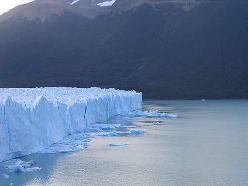
Showing posts with label Glaciers. Show all posts

Friday, 2 September 2011

Met Office Work Experience - Day 5 (for 25-08-2011)

I realise that these posts on what I did at the Met Office are like a week late but I thought that, because I had such a great time and learnt an incredible amount, I would still write them! Well, what did I get up to on my last day with the Met Office?

First up was a very interesting discussion with a researcher about ice sheets. There is currently a lot of uncertainity about ice sheets and their stability, with much of this uncertainity stemming from a lack of understanding of the mechanisms for ice sheet melt. Currently, it is believed that Antarctica is the most likely to experience significant melt and this is because much of it is under the sea. If the proportion that lies below sea-level was to melt, which scientists think could occur over the next few hundred years (although this may sound quite slow, it is considered to be rather rapid!), it would raise global sea-level by 6 metres!!! Greenland melting is an area that often recieves much attention, perhaps becuase we are unsure just how much freshwater could be released or how quicly it would occur, but for now alteast, many feel that a large freshwater input is unlikely. Before this discussion, I had never really given much thought to the influence that the angle of the bedrock, upon which the ice sheet lies, on melting but it does, in fact, seem to play quite a large role. The bedrock that the Greenland ice sheet lies upon slopes away from the sea, whilst that in Antarctica slopes towards the sea and thus making runaway melting possible. When the Laurentide Ice Sheet existed it was sat upon 'flat' bedrock, something that many considered essential for the occurence of Heinrich events. Due to this, depsite the fact that models currently cannot replicate Heinrich events, it is believed that this current climatic state cannot provoke Heinrich events. The fact that surprised me the most was that increased surface air or sea surface temperatures, as a result of global climate change, are not the biggest threat to the stability of ice sheets and would not be responsible for instigating the greatest volume of melt. Instead it is increased wind speeds.....but why?
This is a bit of an exaggeration of what happens but
hopefully you get the general idea....
Well, increased wind speeds would raise the height of local sea-level and increase Ekman Pumping. Increased Ekman Pumping would provoke old warm waters from the deep ocean to be dragged closer to the surface and over the terminal morraine, which marks the end of glaciers or ice sheets, and towards the base of the ice sheet, thus causing melting to occur. This is believed to be responsible for more melting than raised surface air/sea temperatures. One thing that scientists are unsure of though is what happens to the warm water once it passes the terminal morraine. Does it hit the base of the ice sheet and then continually circle, gradually melting away the base or does it bounce back off and return to the rest of the ocean? Understanding this is, again, crucial if predictions of ice sheet melt are to become more cetain.....

Anyway, all of this 'stuff' is important if scientists are to make more certain predictions of the future of the MOC and there is a lot of debate over just how much of an impact melt of Greenland or Antarctica would have. Most focus is placed on Greenland, as a result of its location. Some feel that perhaps, if enough of Greenland melted, it could significantly reduce the MOC intensity whilst others believe that, due to existance of sinking sites either side of Greenland, that Greenland melt could provoke a switch in sinking sites to the western side of Greenland - a switch that could have the potential to actually warm the UK during winter. There are a couple of other quite specific topics that we covered but I think I will leave them for another blog post.

After this I attended a Modelling Team meeting which was quite interesting as it provided an insight into some of the work that researchers at the Met Office are currently doing and some of the problems they are facing at present. Following this I had a chat with someone regarding ENSO, a topic that fascinates me, and as, again, there was lots that we covered,and I am a bit more confident about talking about ENSO, I am going to write another post solely on this. The afternoon was finished off with a chat about the relationship between the ocean and atmosphere and how this relationship is replicated in models. The relationship between the ocean and atmosphere is really really complex and I literally touched the very very basics. The ocean is sort of like the memory of the Earth climate system. The atmosphere cannot store things, like signals or changes in climate, and so instead it passes the signals on to the oceans. The oceans can store this information for hundreds and hundreds of years, whilst it circulates them around the world, and then passes the signal back to the atmosphere where it provokes a short term, but rapid, response. This coupling is crucial for many things such as ENSO. It is tricky to model all of the processes that link the oceans and atmosphere and all of the exchanges that happen between them (I am in the process of writing a post on the real basics of climate modelling as it is like a whole new science).

I apologise as I realise that all of my posts regarding my time at the Met Office have been a bit all over the place but I honestly learnt so much and I am not that great at explaining things. Despite this, I still hope they have been interesting to read and have given you a bit of an insight into the work done at the Met Office and some of the things I was fortunate to do whilst up there. I really cannot thank the people who made this whole experience possible enough - I learnt an unbelievable amount, gained some invaluable advice universities courses and careers etc, got to meet some great and highly intelligent people and simply had just an amazing time!!!

Sunday, 12 June 2011

Glaciers - A summary

I think I am in danger of making quite an interesting topic sound quite boring and so, for the moment, I think I will leave it here. I thought I would do a little summary of the basics what I have (hoped to have!) covered so far.........

Glaciers are an open system with inputs, outputs, processes and stores.
  • INPUTS = Precipitation (primarily snow), Avalanches and the Zone of Accumulation
  • STORES = Ice
  • PROCESSES = Plucking, Abrasion, Flows (all the different types), Ablation, Accumulation and Freeze-thaw
  • OUTPUTS = Meltwate, Moraine, Zone of Ablation
Glaciers originate from heavy, prolonged snowfall and are made when loose snow, that settles, becomes more and more dense.
  1. Loose snow settles
  2. As it becomes more dense it turns into Firn (which is also known as Neve) and then further alterations in weather (as seasons change etc) provoke freezing and thawing which converts the loose snow into icy granules
  3. As more snow falls, it get more and more compacted. This creates pressure between the individual granules and therefore initates pressure melting
  4. Eventually this turns into a dull, white, structureless mass that is less permeable than fresh snow
  5. Air is squeezed out of the ice particels as they are forced to fuse together after further compression by the extra weight of additional ice and snow. This process is known as sintering.
  6. The resulting glacier takes a blue tinge and contain very few air spaces, making it impermeable to water
Snowflakes -----> Granular snow -----> Firn (or Neve) -----> Glacier ice

Glaciers grow and retreat......
  • When the rate of accumulation is greater than that of ablation the glacier advances = positive regime
  • When the rate of accumulation is less than that of ablation the glacier retreats = negative regime
Glaciers can be warm or cold.......
  • In cold glaciers, the ice is very hard and frozen, right to the bedrock. This is because temperatures stay below freezing point all year round. The absence of meltwater greatly restricts movement and the erosive ability of the glacier.
  • In warm glaciers, during summer, some of the ice melts and, via crevasses, finds its way to the base of the glacier where, the meltwater, acts as a lubricant and thereby allows the glacier to move freely. This encouragement of movement greatly increases the erosive ability of the glacier.  
Freeze-thaw is a really important process of weathering in glaciers.......

  •  Produces jagged, rough rocks
  • During the day water enters cracks in the rocks. Overnight, as the temperature drops, the water freezes. As it freezes it expands by 9% thus placing pressure on the rock which, over time, causes the rock to crack and split. This is a form of block disintergration.
  • Freeze-thaw leaves the rocks in an ideal condition for plucking
Abrasion is another dominant erosive process.....
  • Produces a smooth surface as it acts a bit like sandpaper
  • Glaciers carry a large amount of moraine and some of these sharp boulders are embedded in the bottom of the glacier and act as erosive agents. These rocks scour the valley floor and leave behind grooves which are known as striations
Plucking
  • Like freeze-thaw, it leaves behind sharp, jagged rocks
  • It is considered to be the main erosive process in operation in glaciers
  • As the glacier moves along the valley the ice melts slightly around large boulders, and other obstacles, before refreezing around them. As it then advances further the boulders are literally ripped out of the ground. From this point onwards, the boulders ofen act as agents of abrasion.
From this, it is clear to see that despite the forms of erosin being seperate and slightly different to each other they are all interlinked and help to increase the rate at which each one occurs.

There are three main ways in which glacial debris is transported......

- On the surface ---> supra-glacial
Derived from forst shattering of peaks above and lateral moraines meeting after tributary glaciers join.

- Within the ice ---> englacial
Debris falls down through cracks and crevasses in the ice.

- At the base ---> subglacial
This is a mixture of material scarped up from below the glacier and that which has made its way downwards through crevasses, with or without the help of meltwater streams within ice.

Glacial sediment is classified according to its mode of deposition but the collective name for all the sediment and debris deposited under glacial conditions is Glacial Drift. Sediment that is depostied by melting ice or glacial streams is known as Fluvio-Glacial whereas that deposited directly by the glacier, such as moraine and intra-glacial debris dropped in site by retreating ice, is known as Glacial Till.

Well, that it most of what I would consider to be the real basics of glaciers. There is still so much more surrounding this topic and so I think I will pick it back up during the summer holdiays as I have yet to cover topics including ice sheets and their processes and landforms (which will also include lots more on depositional landforms which can also be found in valley glaciers but the size and extent of them are far greater from ice sheets), the effects of meltwater on landscapes, periglacial processes and the resulting landforms and a bit about permafrost.

Glaciers Part 6 - Glaciated valleys

A valley glacier changes the cross profile, plan and long profile of a pre-existing river valley down which it moves. The underlying explanation for all three changes is that the glacier occupies and fills the wholes of the valley floor. Ice erosion takes place wherever the ice is in contact with rock, whereas earlier direct erosion by the river took place only in the small part of the valley where the stream was flowing. When ice is present, meltwater streams are everywhere - within the ice, under it and along its sides; therefore, ersoion is no longer concentrated in one place. River water passes through the system quite quickly, but glacier ice is stored in the system for a much longer time. Ice movement is slow but it is inevitable and unyielding; although ice deforms plastically when it flows as its mass pushes it forward in a straight line wherever possible. Rivers naturally swing form side to side and flow around obstacles forming interlocking spurs. Rivers are less powerful than glaciers. However, the protruding spurs of higher land are cut off, or truncated, by the relentless down valley movement of the ice mass of a glacier. The ice takes away the edges of the valley floor and the lower slopes are eroded by glacier movement which creates the flat-floored, steep-sided and straight valley - the classic  feature of a glaciated valley. The previous positions of the interlocking spurs are marked by higher tops to the valley sides. Today's tributary streams cut their small valleys between truncated spurs before dropping down the stepp valley sides as waterfalls. Above that part of the valley filled by ice, high level benches or shoulders of less steep land are sometimes present.
The irregular long profile of glaciated valleys requires a seperate explanation. The uneveness of the valley floor is partly a reflection of lithological variations, principaly rock resistance and the degree of joitning (a little test to see how much of that 'Geology for Geographers' lesson we had a while ago you can remember!). Soft and well jointed rocks are vulnerable to severe abrasion and plucking. Once a rock basin begins to form, some of the characteristics of ice flow increase its size. For example, extending flow increases ice thickness as it fills the hollow. This increases the weight for abrasion, and leads to more pressure melting at the base of the glacier which encouragesplucking. Another reason for the localized valley deepening is additions of ice. A steep drop in level often occurs towards the head of the valley after cirque glaciers and ice caps increase the size of the glacier in the main valley, theerby giving a increasing its erosive ability.Tributary glaciers joining the main glacier lower down the valley have a similar effect. Hard rock outcrops reduce the valley's width, constricting the glacier, but speding up its rate of erosion as it forces its way through. Where the glacier has melted it can no longer erode and so rock lips or rock bars form (rotational slip also contributes to their formation). Rock bars also form on the seaward edge of a fjord near to the maximum extent reached by the glacier.

Glaciers Part 5 - Cirques, aretes and horn peaks

A cirque (or corrie) is a deep, armchair-shaped hollow high up on the mountain side. The high, steep and rocky headwall, which is frequently 1000m or higher, extends around the back and sides of the cirque. The front, however, is open and often marked by a lip of hard rock. The hollow that is left after the ice has melted forms a natural catchment area that is usually occupied by a circular tarn lake. More cirques are located on the northern and north-eastern facing sides of mountains in temperate lands of the northern hemipshere where it is easier for the snow to accumulate away from direct sunlight.

Nivation hollows from which cirques begin are widespread features in mountainous areas. They form under snow patches which grow sufficeintly to enable meltwater to penetrate crackes in the rock to provoke freeze-thaw action. The weathered material is removed by a mixture of flowing meltwater and solifluction which leaves newly exposed rock surfaces are subject to attack from frost action. As nivation hollows are deepned they become potential sites for ice accumulation and the formation of cirque glaciers.

Freeze-thaw weathering is crucial in there formation as it weakens exposed rock surfaces before they are covered by ice and then continues to attack and sharpen up all rock outcrops above the ice. Wherever water seeping under the ice reaches the headwall, such as near the base of the bergschrund (the semi-circular tensional crevasse that is usually present near the top of the cirque glacier), there are oppurtunties for frost action to operate. There is also pressure release, which leads to sheet jointing parallel to rock surfaces. These joints are important in providing weaknesses for the plucking action of moving ice to pull pieces of rock away from the back wall. Both freee-thaw and plucking provide the conditions needed for abrasion to occur. A rotational element in the movement of a cirque glacier is caused by the imbalance between great ice accumulation in the hollow and little wasting at the snout and this results in the force of the glacier being concentrated on the back of the hollow. It is here at the base of headwall that the great abrasive power of ice ice concentrated. Rotational slip not only helps to explain the great height of the back wall of the corrie, but also the presence of a rock lip on the open side where the erosional power of the cirque glacier is much less.

The cirque lip is made of bedrock and its origins are erosional. However, on some rock lips there is a capping of deposited glacial material. There are two explanations for this. One is that the moraine was deposited as the glacier retreated up valley to iits last resting point within the cirque hollow. The second is that it represents the terminal moriane for those ciruque glaciers which do not grow large enough to flow out of the source hollow.

What happens in the cirque basin is the first stage in sharpening the rounded relief from pre-glacial times. As the head walls of two cirques cut back on either side of a ridge, impressively sharp knife-edged ridge tops are created. The arete is kept sharp by frost shattering. Where three or more head walls cut back, the orginal mountain mass is reduced to a three or many sided slab of rock, of which Matterhorn is the classic example.

Saturday, 11 June 2011

Glaciers Part 4 - Glacial Transport

Greatest rates of valley glacier erosion occur in mountainous regions where thick glaciers, well nourished by new supplies of snow, are flowing down steep-sided slopes towards a free outlet, such as a large lowland area or the sea. Some of the pre-existing river valley are often enlarged into spectaaculr glacial troughs, the lower ends of which have been drowned by post glacial rises in sea level to form fjords and many of the world's most rugged coastlines and deepest natural harbours.

The glacial debris removed by erosion or picked up for transport is an unsorted mass of sharp edged rocks and stones, boulders, clay and sand. Some debris is carried on the glacier's surface to produce two distinctive lateral moraines down each side. Frost shattering on rocky peaks above adds to that removed from the valley sides by ice erosion. Lateral moraines join together after tributary valleys have met and several lines of medial moraines may develop on wide glaciers. Close to their snouts many glaciers have a dirty appearance; the presence of surface debris gives the ice and lower albedo and sppeds up melting. A lot of dberis sinks down through the crevasses, some of which is carried englacially, although much reaches the base either carried or moved further down by meltwater. This is added to the sub-glacial material already present having neen removed by abrasion and plucking. Movement reduces the size of eroded pieces of rock and particles; the end product of the operation of the process of erosion is rock flour, fine grained materail carried away by meltwater streas. Under dry condition, it is capable of being picked up and transported by th strong winds.

So, Glacial transport (in short):

-On the surface ---> supra-glacial
Derived from forst shattering of peaks above and lateral moraines meeting after tributary glaciers join.

-Within the ice ---> englacial
Debris falls down through cracks and crevasses in the ice.

-At the base ---> subglacial
This is a mixture of material scarped up from below the glacier and that which has made its way downwards through crevasses, with or without the help of meltwater streams within ice.

Glaciers Part 3 - Why are valley glaciers so erosive?

Ice movement is needed for erosion to occur. In flow ice behaves plastically as stresses within it increase with movement; this takes place by a mixture of basal slippage (this is when, during summer, limited melting occurs and lubricates the base of the glacier, thereby allowing it to move more freely) and internal flow. At its base the ice creeps plastically around obstacles such as rocks. It also melts on the upstream side of the obstacle which aids movement, only to refreeze again after passing over or around the obstacle. Internally the force of gravity means that individual crystals of ice flow within the glacier. Therefore, the pattern of crevasses tell us a great deal about the stresses and strains which are occuring within the glacier as it moves.
In the corrie


In the valley
The two main processes of glacial erosion are abrasion and plucking.

Abrasion:-

Rock fragments embedded in the nase of the glacier are foced, by the weight and pressure of the ice above, into the bedrock below as the ice moves. These pieces of rock are angular; their sharp edges are driven into the bedrock. Exposed bedrock surfaces are scarred with fine grooves or more deeply scratched by striations, which run in parallel lines and act as a good indicators of the direction of the ice movement. If smaller-sized debris is trapped in the bottom of the glacier, upstream rock surfaces are more likely to be polished. In all cases the height of the exposed rock is reduced and it is worn down.

The rate of abrasion is greatest when certain favourable conditions are present. One is a great thickness of ice, which will fill both the floor and the sides of the previous river valley and exert great pressure on a wide area of exposed bedrock. A second condition is'rapid' speed of flow. Not only is meltwater frequently presentat the base of these warm glaciers, but by beginning in high mountains the glaciers are flowing down steep gradients as well. A large ice budget also helps. Much new accumulation is matched by much additional ablation meaning rapid ice through-flow. Beign funnelled down an already existing valley is another contributory factor to rapid  and sides. This is confined to a zone close to the rock and is called Blockschollen Flow. The loose rocks in the glacier are dragged against the base and sides. The unevenness of th efloor over which the glacier is moving produces sequences of extending and compressing flow. As the glacier flows into a hollow the effect if increased gradient is to speed up the glacier movement and the ice becomes thinner. On leaving the hollow there is a reduction in the gradient, which leads to the glacier slowing down and to the ice thickening. The greater pressure on the stones trapped in the base of the glacier from the increased weight of ice above leads to greater abrasion, which in turn increases the depth of the hollow, thereby emphasizing further the uneveness of the valley floor.

Diagram showing Normal Flow and Blockschollen Flow

Diagram showing Extending and Compressing Flow - as with all the diagrams I have
included in the glaciers post, I apologise for the size of my writing as I am known for having
quite small handwriting as I am not great at writing big - I hope you can read the labels though!!!

Clearly the characteristics of the rock over which the ice is flowing were of great importance to the rate of abrasion. Softness and plentiful jointing were great aids to abrasion. Also many of the river valleys down which the glaciers passed had been affected by periglacial processess for a prolonged period before the glaciers arrived. Frost action preceded glacial action, leading to deep shattering of rock on the valley floors and sides, which made glacial abrasion easier and quicker and provided the tools with which to do more work.

Plucking:-


<><>
<>
<><>
 Formation of a Roche moutonnee

This is the pulling away of fragments of bedrock. From time to time glacier ice freezes and sticks to the bare rock below it. Later blocks of rock are pulled away by ice movement. Its effective operation relies upon alternate freezing and thawing taking place in the base, which is most likely to happen in two types of location where high rates of plucking are favoured. One location is where ice passes over a rock step on the valley floor. At this point the glacier is likely to be thinner and heavily crevassed. Both water and warmer tepmeratures may be able to penetrate to the rock face more regularly to create the ideal conditions for plucking. The second  is around an obstacle such as a hard rock outcrop. The increased weight of the ice upon the upstream side of such an obstacle often leads to pressure melting, even where the temperature is below freezing point. The water freezes on the downstream side of the obstacle where pressure is reduced. In both locations, the presence of weaknesses in the rock, especially joints, is of great importance. Water flowing into these is trapped there by refreezing, thereby helping to loosen pieces of rock over time. These are the chunks of rock plucked away by the forward thrust of glacier movement.


Other erosion factors:-
Frost action is a type of physical weathering and it operates whenever there are changes in temperature above and below freezing point occurs. The greater the frequency of these changes, the faster it operates. diurnal changes between night freezing and daytime thaw are most frequent in early and late summer, at the change in seasons and so freeze-thaw occurs rapidly and most effectively at this time. On rock outcrops, protuding above the glacier, it is the main process of denudation. It also effects rocks on the bed and sides of glaciers that are well jointed.

Frequent references have been made to freeze-thaw weathering, without which valley glacier erosion could not be so effective. Other factors are believed to help glacial erosion. One is pressure release. Ice has only one third of the density of rock. After ice erodes and removes rock, the weight of the ice is less than that of the rock removed. As pressure is released, rocks expand slightly and cracks develop running parallel to the surface. This is called sheeting. These are weaknesses into which water can penetrate, increasing the oppurtunities for freeze-thaw to occur and providing more shattered rock for the ice to remove. Another factor is erosion by sub-glacial meltwater streams. Meltwater works its way down through the oce into underwater streams, which flow under conditions of hydrostatic pressure in the glacier's base. The potent mixture of ice pressure and large amounts of water makes the streams perfectly capable of undertaking considerable fluvial erosion and cutting steep-sided V-shaped valleys under the ice. Some valleys are recognised by their uneven floors because, uniquely under hydrostatic pressure, streams can locally flow uphill.

There is lively debate about the relative effectiveness of abrasion and plucking. Some researchers have suggested that abrasion does no more than scrape, scratch and smooth off rock surfaces. They contend that plucking is more effective. Plucking undoubtedly operates most effectively where pre-existing rock fractures are present. It has been discovered that a joint giving blocks between one and seven metres in size seems to favour the maximum removal of bedrock by ice. Others argue that in the absence of jointing even soft rocks may be able to resist ice erosion by plucking. How could the many, very deep rock basins found on the glaciated valleys be formed if not by ice abrasion? The dark colour of many rivers fed by melting glaciers is due ot the ready availability of load materials at the glacier's snout. However, no one disputes the vital part played by freeze-thaw in the preparation of the rock for abrasion, plucking and transport by valley glaciers.

Sunday, 5 June 2011

Glaciers Part 2 - Processes and Landforms linked with Valley Glaciers


Lauterbrunnen valley in Switzerland

A valley glacier is a glacier which extends from a larger body of ice, most commonly a corrie, and moves downslope taking the path of the existing river channel but, over time, the glacier cuts its own wider, deeper and straighter trough.

Valley glaciers are powerful agents of erosion and are directly responsible for the deepening of pre-existing river valleys and so, thereby, they contributed greatly to the spectacular scenery found in many mountainous areas. Due to their erosive ability they have exaggerated, in what can be described as quite a dramatic manner, the vertical difference between the frost-shattered peaks and the valley floors that lay below. This can be clearly seen in mountainous regions in temperate latitiudes as large areas are clear of ice and the landforms have been created relatively recently so  they have not been obliterated by further denudation (stripping of surface cover - applies to both vegetation and soils). The Lauterbrunnen valley in central Switzerland is a classic example. The pre-glacial river valley has been greatly straightened, widened and deepened by the presence of ice and its erosive ability. The resulting glacial trough has a deep U shaped cross-section and the present river is lost within the cavernous spaces of the glacier-carved valley.  The former interlocking spurs have been planed off to give the valley a straight plan with their remnants left behind in the form of high points on the valley sides which are known as truncated spurs. Streams are left hanging from the top of the glacial trough  and cascade down as waterfalls to the valley floor far below.
This image shows not only a truncated spur and how flat the valley floor is but it
also demonstrates the common U-shaped cross section
Although a smooth valley cross profile is created, the dominant feature of the long profile of a glaciated valley is, often, its irregularity. The sudden drop that occurs at the head of the valley is known as the trough end. When the glacier was present, it would have exploited weaknesses within rocks, mainly joints, and variations in resistance between rock strata's as it moved down the valley. The more resistant rock outcrops form into steps or rock bars, whereas less resistant rock erodes into rock basins. Water on the land later fills up the basins to form ribbon lakes, some of which are of great depth and considerable length.

 Exposed bedrock surfaces are normally scarred with fine grooves or more deeply scratched by striations on their upstream sides and quarried by plucking on their downstream sides - making them more jagged. Rock that has eroded is transported, only to be deposited once the carrying capacity of the glacier is reduced due to melting. A ridge deposited across the valley floor at the maximum point reached by the ice forms a terminal moraine. This can be the first in a series of ridges, or recessional moraines with each one representing a point in the valley where the glacier remained stationary for a period of time. The floor of the glacial trough is, often, covered with glacial debris which can be classed as ground moraine.

A moraine is simply a pile of deposits and these depostional landforms can be classified into one of 4 groups depending on their location.
  • Terminal moraines are found at the furthest point reached by the glacier (known as the terminus end)
  • Lateral moraines are found along either side of the glacier
  • Medial moraines occur at the meeting point of two glaciers
  • Ground moraines are disorganised piles  of rocks of various sizes, shapes and rock types
Where ice is still moving freely, some of the mounds of boulder clay are shaped into egg-shaped hills called drumlins. Drumlins are elongated hills of glacial deposits that can be anything up to 1km long and 500m wide. Drumlins often occur in groups known as drumlin swarms (or a basket of eggs like found in the Vale of Eden). They form when the glacier is carrying too much sediement and so deposits it meaning the the debris that the drumlins is comprised of is the sediment which accumulated under the ancient glacier or is accumulating under glaciers at present. This also means that the long axis of the drumlin will indicate the direction the glacier is/was moving in. 

Drumlins in the Vale of Eden, Lake District

A diagramatical plan view of a drumlin
However, in most places the hummocks and mounds are irregular heaps of glacial till and so, in general, these landforms of deposition are more minor landscape features in comparison to those created by glacial erosion.

So, hopefully, this outlines some of the main features found in valley glaciers and the impacts of erosion and deposition and so next I think I will move on to discuss just why valley glaciers have such a great erosive ability with reference to the types of erosion that actually take place.

Friday, 3 June 2011

Glaciers Part 1

I have to admit that I am a bit lost with no college work to do and so I thought that I would try and teach myself the basics about glaciers as I seem to mention them quite a bit on this blog but, on reflection, I don't actually know a lot about them and the processes and landforms associated with them.

So, firstly, a bit of glacial terminology........
  • ICE :- (I thought that frozen water would be enough, but apparently not) Ice is snow which has been compacted so that the air passages between the individual crystals of snow become sealed, thereby increasing the density. The density has to be greater than 0.85 for it to be classed as ice.
  • GLACIER :- A moving mass of ice on a land suface
  • ICE SHEET:-  An ice sheet covering a plateau region, over an extensive area. Movement around the edges may be faster because of steeper gradients.
  • CIRQUE GLACIER:- After snow has continued to accumulate in a hollow on a mountain side, ice forms and thickens with time. Ice fills the cirque (also known as a corrie) hollow, which is deepened. the glacier may grow to the point where it spills out of its semi-circular hollow into the valley below.
  • VALLEY GLACIER:- A glacier following the line of a pre-existing river valley, fed by cirque glaciers or ice caps. These can be extremely deep and the moving tongue of ice can extend from some distance, down the valley, until it reaches the lowlands or the sea. 
  • PERIGLACIAL:- Applied to land areas which lie around the margins of ice sheets. They are cold areas where permafrost exists either continuously (everywhere) or discontinuously (in patches only).
  • PERMAFROST:- Permanently frozen ground of which only the surface layer thaws breifly during summer. This layer is known as the active layer.
And a few keys dates surrounding the Pleistocene Ice Age.......
  • 2 million years ago = the onset of the Pleistocene Ice Age
  • There have been four major ice advances known as glacials
  • These were seperated by warmer periods , called interglacials, where the ice retreated
  • Anglian is the name given to the first glacial advance in Britain and it occured around 500,000 years ago
  • The maximum ice advance was during the third glacial advance, known as the Wolstonian glaciation in Britain, which ended about 125,000 years ago
  • The Ipswichian (also known as Eemian) interglacial period was particularly warm and so provoke great ice retreat
  • The fourth and last ice advance ended around 25,000 years ago and was called the Devensian glaciation
  • Progressive warming of the Earth (although there have been a few notable fluctuations) has occured since the end of the Devensian glaciation and the end of the Pleistocene Ice Age is usually dated as around 10,000 years ago

Glaciers form when the amount of snow that falls throughout the year exceeds the amount which melts and they can only form above the permanent snow line. Most glaciers originate from a snow patch in a hollow on a mountain side. Once this hollow becomes filled with snow, the hollow itself, is enlarged by various types of weathering and nivation (the proper collective term for all the erosional processes that occur under a snow patch). This weathered material is then easily washed away by snow melt.

Freshly fallen snow has a low density (under 0.5) due to the large amount of air trapped between the individual crystal. However, as more snow falls and the snow patch enlarges, the old snow becomes compacted. More air is then expelled by the successive melting and refreezing and if the snow manages to last a year it turns into higher density firn or neve (which has a density of around 0.7). After further annual snowfall the firn becomes more and more compacted due to the sealing of further air spaces. The crystals start to grow larger, again increasing density, until the density grows to above 0.85 - the point at which snow is considered to be ice. This transition from snow to ice can take up to 200 years in areas like Antarctica as the continually low temperature prevents melting and refreezing, which speed up the process, or only around 5 to 10 years in slightly warmer martime environments such as Alaska.

Glaciers are examples of open systems. Their main input is snow, either from direct snowfall or from avalanches. This snow accumulates in the upper part of a glacier and is stored, in the system, as glacier ice which is carried downslope by the glaciers movement. The main output of this system is water (no surprise there!) and, although some water does evaporate directly from the surface, most water loss results from the ice melt as lower altitudes, or latitudes with higher temperatures, are reached. Further melting occurs at the sides, where the glacier meets rock  with a much lower albedo than the glacier ice itself, and as internal or basal melting. On top of this you also get calving where icebergs break off into streams, lakes and the sea.

Ablation is the term for the net loss of ice and above the snowline, the accumulation of snow is greater than ablation. The point where the systems outputs exceeds the inputs is reached when  the zone in the course of a glacier where accumulation is replaced by the zone of ablation has been reached. When the amount of new snow and ice is excatly balanced by the amount that has melted, a steady state is said to exist and the glacier remains stationary. However, often the position of the break point between the zones of accumulation and ablation changes from year to year (or sometimes over a longer period of time). When the balance is lost the snout (the front of the glacier) of the glacier either advances or retreats. Despite the warming of the Earth over the last 10,000 years provoking greater retreat; colder interludes have allowed for local ice advances. One such interlude was the 'Little Ice Age', which lasted for around 500 years (starting in 1350) and reached its worst in the late seventeenth century when it was nearly cold enough for the re-development of the Laurentian ice sheet in North America (during this period the River Thames, famously, kept freezing over). However, current global warming is encouraging glacial retreat everywhere and calving great icebergs off the Antarctic ice mass with some ice masses being equivalent to size of smaller European countries and Mediterranean islands.

Of great significance to the speed and effectiveness with which glacial processes operate is the size of a glaciers budget. Calculating the budget involves measuring the inputs in the zone of accumulation and outputs in the zone of ablation, as well as any change in the volume of glacial ice in store (sounds a bit similar to the water balance equation we learnt in the rivers module to me). Glaciers in mountainous areas on the western sides of continents feel the full force of the prevailing westerly winds and depressions, like in Norway, and many have snow inputs well above 2000mm (in water equivalent). Lying on the southern edge of the polar region much melting also occurs. A high budget such as this, accompanied by the effects of gravity from the steep relief, encourages faster glacial flow than in continental ice sheets. In interior Greenland and Antarctica less than 50mm of new snow may be recieved during a year, although the intense cold means that little is lost from the system, which means that the ice budget is low.

Ice budget is one of the factors used in the classification of ice masses into either ice sheets and valley glaciers and it also supports the basic thermal division between cold glaciers and warm glaciers. Continental ice sheets are cold glaciers, so called because the temperature throughout the glacier ice remains below freezing point all year round. The ice is therefore frozen to the bedrock below, which slows down the glacier movement to, often, as little as a few centimetres per year. Despite having greater thickness and weight, the lack of movement limits the erosive ability of the glacier and so the amount of glacial erosion that occurs. In contrast, valley glaciers are warm glaciers and many are located in temperate latitudes where meltwater is plentiful in summer - although during winter the some surface ice will melt. This means that water is making its way down through the cravasses in the ice to the base of glacier on many days of the year. Water can also be present at the base of the glacier even when the temperature is falling below freezing point as a result of the weight of the ice above and the friction of movement against the bedrock causing localized melting a the base. The presence of so much water is significant in easing movement and encouraging erosion.

So, thats kind of the beginnings of the the stuff about glaciers that I am trying to understand - sorry I realise that it is a bit long and wordy but I am still banned from talking about anything Geography related at home and so I am kind of just blurting it out on here instead. Next, I think I will move on to the processes and lanforms in valley glaciers and then the glacial processes that exist - with a lot more pictures and diagrams, I promise!

Friday, 20 May 2011

A bit of Geography related news..........

So, the Geography exam is out of the way now - I hope it went well - and so I can finally move on from writing revision related posts (which I hope were useful) and start writing about some slightly more interesting things. I thought I would quickly outline the things I am planning to write about over the next few weeks, once I have finished the rest of my exams, whilst we don't have any Geography lessons. So, firstly there will be a few book and film reviews that I have been meaning to write for the past month or so followed by some more in depth posts into interesting and easily debatable areas that haven't fitted into the sylabus we have just finished and just some general Geography topics that I don't really know alot about but would like to. I hope it doesn't get too boring or that I start to scare you with my enthusiam but I have been banned by my family from talking about anything remotely Geography related for the next three weeks, until lessons restart, and have been told to write it all on here, so they can be spared from it - I think it is safe to say that they aren't as interested in Geography as I am!

Tonight it is only going to be a short post (I think) from me on a few stories that I have read in the news that have caught me eye........

  • Ever since the Deepwater Horizon Oil spill last year, the way in which countries and oil companies are able to respond to such disasters has come under public scrutiny, with many calling for more preparation and better methods incase such a disaster was to occur again. Well, this week, the UK tested its planned repsonse to an oil spill off to the west of Shetland. The exercise, named Exercise Sula, involved the use of oil spill containment booms and planes spraying water to simulate dispersant. The aim of the exercise was to test the responses of the numerous authorities that would be involved in a response to an oil spill. However, perhaps, the greatest obstacle faced by the authorities involved was dealing with the weather conditions. Over the two day exercise, winds frequently reached 50mph and strong waves that prevented the the full extent of the booms, which would be required normally, to be set out whilst the pretend dispersant was been blown everywhere and anywhere. Therefore, this suggests that, perhaps, this is the not necessarily the best method to use in the repsonse to an oil spiil - especially if one was to occur during winter! However, atleast it can be said that we are taking an active role in improving the global preparation for another oil spill which, because we are digging deeper and deeper wells, the probability of such a disaster occuring again is increasing. This National Geographic article would be of interest to anyone who is interested in the regulations in place in the USA about drilling oil wells in the Gulf of Mexico and anything else linked to BP and exploration for oil in this area of the world - While BP Eyes Return to the Gulf, Safeguards Debated .
  • I have personally never thought about a possible link between earthquakes and glacial lakes before but apparently the relationship between the two could be disasterous for countries, such as Nepal , which lies at the base of the Himalayas. The Himalayas is a sesmically active region that is covered in glacial lakes which, due to the melting of glaciers, are growing and with an earthquake, predicted, to be overdue, the risk of one of these glacial lakes rupturing threatens to flood huge areas downstream. The epicentre being close a glacial lake, thereby causing it to 'explode', is not the only way in which an earthquake has the potential to rupture these growing lakes. Avalanches and landslides, which can be provoked by earthquakes, can also have a similar effect. For example, in 1985 the glacial lake Dig Tsho, in eastern Nepal, ruptured due to an avalanche and it resulted in the flooding of a nearby HEP plant and much other infrastructure. So, why has this not been a big problem before and why are people only just starting to sound their concerns? Well, the last time a big earthquake occured in the Himilayas was in 1934 and the glacial lakes only really started to appear in the 1950's and they have since grown, therefore have come into closer contact with the most sesmically active areas of the Himilayas. This poses a huge threat for many countries lying at the base of the Himalayas - most of which have large and expanding populations...........
  • Switching now to the other side of the globe, to another worrying story. The deforestation rates in Brazil are on an increase with 480 kilometres squared worth of forest being lost over 8 weeks in the Mato Grosso region - a fivefold increase on last year. This increase is believed to have been caused by the uncertainity and the public political disagreements over the forest consevation rules which vary spatially with farmers in the Amazon having to preserve 80% of the forest whilst farmers elsewhere onyl have to preserve 20% - Lets just hope that this new trends does not continue and Brazil reverts back to reducing its deforestation rates which fell to their lowest since the 1980's last year.
  • A bit of Geography TV now....... I watch the first episode of Windfarm Wars as part of my revision for the exam and I just caught the second episode on BBC iPlayer. Windfarm Wars is a 4 part documentary that follows the struggle of windfarm developers as they try to persuade the council and locals, in a village near Dartmoor, to allow for the development of a wind farm nearby and they processes they have to go through and the problems and opposition they face. This is the link to the first two episodes if anyone is interested - http://www.bbc.co.uk/iplayer/search?q=Windfarm%20wars
  • China has now acknowledged the problems associated with the Three Gorges Dam and has said that steps need to be taken to help the 1.3 million displaced by the construction of this $40 billion project, protect the environment and prevent any major geological disasters occuring.

  • And finally, a quick update on the future of nuclear power. The findings of the initial report commisioned by the UK government was published this week and concluded that there is no need to prevent the further development of nuclear power in the UK because of the events in Japan. Protection against coastal flooding was taken into account in this report as rising sea levels could threaten most of the nuclear power plants in the UK as they are built along the coast but all were found to be suffieciently protected. The situation in Japan is slightly different as the Prime Minister has announced that the country will not build any new reactors and instead, to make up the energy shortfall, greatly increase its use of renewables - especially wind.

This blog is likely to be greatly neglected until half term and all my exams are over and so good luck to everyone in the rest of your exams - especially to those of you resitting the skills exam on Tuesday. Encase you havent read Millie's blog recently or seen the FB page, she is running an online revision session on Monday evening at 19:30 - I am sure it will be very beneficial to join in - and so check out her blog for more details.

Monday, 21 March 2011

Ice

I am not quite sure what to call this post as it is likely to end up jumping all over the place but seeing as ice should feature in all of the things I am going to try to explain I thought that it would do.

Firstly I am going to discuss albedo. Albedo is a measure of the reflectivity of different objects and surfaces on the earth and the lower the number the more energy that is absorbed, which is believed to contribute to global environmental climate change (or what ever the new term for global warming is). The most reflective surfaces are snow and ice, which have the ability to reflect as much as 90% of the sun's energy back to space. Black carbon (I think it is practically that same as soot) is considered to be one of the largest contributors to climate change, even though unlike all of the other polluntants it is not a gas and it is the shortest lived as once we stop emitting it, it would stop trapping heat in the atmosphere within a couple of weeks. If this is true, then why is black carbon emissions so potentially problematic and what is its link to albedo? Well, black carbon has been closely linked with the acceleration of the melting of ice and snow around the world and thereby a reduction in albedo. The largest source of black carbon is from the burning of biomass which occurs a lot in Brazil, Indonesia, Central Africa and this accompanied with the black carbon produced in Siberia and Eastern Europe by forest fires and the seasonal burning of ground cover has contributed greatly to the progressive disappearance of the Arctic's sea ice cover, as the prevailing winds have carried this polluntant to the Arctic. This is also effecting the Himalayan glaciers. It is believed that 20% of the black carbon in the atmosphere is the result of burning wood, dung and crop residues for household cooking and heating in India. The increasing use of coal-fired power stations in China has added to the black carbon that it produced in this region and, due to the seasonal weather patterns experienced, black carbon poses a particular threat to both India and China. The Indian subcontinent normally experiences 6 months lacking in rain surrounded either side by monsoon seasons and this temperature inversion (a situation where the temperature of the air in the lower troposphere (the lowest layer of the earth's atmosphere) increases with height), which forms over much of South Asia during that period, traps the black carbon above the glaciers and snow of the Himalayas and the Tibetan Plateau. When the black carbon falls on the glaciers, it darkens their surface which causes the snow and ice to absorb the sunlight instead of reflecting it (basically it reduces its albedo) which accelerates the rate of melting. Not only is this likely to present huge issues surrounding water supplies for countries like India, Bangladesh and China who rely on the seasonal melting of the glaciers, for example 70% of the water flowing in the Ganges comes from the melting of ice and snow in the Himalayas, but also that it is reducing the earths natural ability to reflect the sun's energy. The results of a 30 year study of the Northern Hemisphere's albedo was recently published and it suggests that the reduction is albedo due to snow and ice loss is more than double than previously thought. The study involved comparing the model estimates of changes in the Northern Hemisphere's cryosphere (portions of the earth where water is in its solid form e.g sea ice, glaciers, permafrost etc.) with the changes in actual snow, ice and albedo measurements over the same period. The study concluded that, during the 30 year period, cryosphere cooling in the Northern Hemisphere declined by 0.45 watts per square metre and that, on average, for every degree of warming 0.6 fewer watts of solar radiation, per square metre, are reflected to space due to reduced snow and sea ice coverage. The reduction in albedo across the global is increasingly worrying scientists who have seriously considered proposing that all building roofs should be painted white to try and imitate the role that ice and snow play in reflecting solar energy to accompany plans to reduce black carbon emissions. However, as densely populated countries such as India and China continue to develop reductions in the global emissions of black carbon are going to be increasingly hard to meet because the burning of coal and biomass are the largest contributors to the production of black carbon.

I am going to go back to the Himalayan glaciers again but this time in reference to the recent publication of research that suggests that debris on the Himalayan glaciers may be helping to keep them intact. The new research suggests that debris such as rocks and pebbles may help to shield glaciers in the Himalayas from the solar energy and therefore slow the rate at which they are melting. The research that was carried out between 2000 and 2008 on 286 glaciers between the Hindu Kush on the Afghanistan-Pakistan border and Bhutan, disovered that half of the studied glaciers in the northwestern regions of the Himalayas were stable whereas two thirds, elsewhere in the region where in retreat. Retreat rates were also found to be high on the Tibetan Plateau, an area that lacks in debris. The scientists have attributed this difference to the amount of debris present on glaciers and they concluded that debris, in the form of rocks and pebbles, has the opposite effect on glaciers to black carbon and dust. It is hoped that this research could help to explain why glaciers in the Himalaya's haven't all responded in the same way to rising atmospheric temperatures and therefore possibly make it easier for us to predict how glaciers are going to respond to changes in atmospheric temperatures in the future which may enable us to predict the impact that the melting of the Himalayan glaciers will have on the people of China and India.

It is a well known fact that the melting of earth's ice sheets could play havoc with sea levels but to what extent has often be debated. The most recent report (sorry - I realise that this post has involved lots of 'recent reports') by the Intergovernmental Panel on Climate Change suggested that sea levels, before taking into account the Greenland and Antarctic ice sheets, could rise by between 18 and 59 centimetres by 2100. Another report, that did include the ice sheets of Greenland and the Antarctic claim that sea levels woudl rise globally by 56 centimetres by 2100. This prediction was calculated by using NASA satellites to estimate the changes in the ice mass by measuring earth's gravity field over Greenland and Antarctica (the gravity field is apparently affected by changes in ice mass - don't ask me how) and by using monthly measurements of glacier movement and ice thickness. Both reports seemed to produce similar predictions and they also noth agreed that the rate of loss of ice is increasing by 36 gigatonnes a year which is roughly three times as fast as the rate of loss from mountain glaciers and ice caps. However the melting of glaciers and ice caps should not be overlooked as it is estimated that melt from mountain glaciers and ice caps will contribute around 12 centimetres to global sea levels by 2100.

From all of the above I think that it is clear to see that the melting of ice has the potential to have catastrophic human consequences from displacing millions due to rising sea levels and hugely influencing th ewater supply of the most densely populated countries in the world and that little is still known about patterns to glacier melts and why some respond differently to changes in atmospheric temperatures.

Sorry it is all over the place and a bit brief but I hope some of you might have found it vaguely interesting. I am ensure as to whether or not it links to any of the Geography ones or not - perhaps one to do with climate change - but even if it doesn't I think it is quite interesting to see what research is being conducted in terms if ice sheets and glaciers and the effects that human activities have on them.